Business Details
29 Years
experience
Your Trusted Land Surveying Partner in North Texas
Hudson Site Control has been delivering professional land surveying services across North Texas since 1997. Our expertise spans traditional and non-traditional surveying methods, including construction staking, topographical surveys, and aerial photogrammetry. With over 20 years of experience, we have established a reputation for precision and reliability on projects ranging from commercial developments to municipal infrastructure. Our commitment to cutting-edge technology ensures accurate data collection and efficient project execution. We prioritize client collaboration, offering tailored solutions that meet specific project requirements.Our team's deep understanding of legal considerations and boundary line surveying guarantees compliance with industry standards. Backed by error and omissions insurance and a strong safety record, we provide peace of mind for our clients. Our extensive portfolio includes work on high-profile projects like the Perot Museum and Facebook Data Center. We maintain rapid deployment capabilities for field crews and quick turnaround times for deliverables. Our dedication to continuous improvement through technological innovation sets us apart in the surveying industry.

Services
Land Surveying
Construction Services
Drafting Services
Laser Scanning
Aerial Surveys
Boundary Surveys
Topographical Surveys
ALTA/NSPS Surveys
FEMA Flood Certificates
Details
- Year established: 1997
Highlights and features
- We offer 25+ years of combined surveying experience with cutting-edge technology
- Our team provides rapid deployment of field crews and quick deliverable turnaround
- We maintain error and omissions insurance for client protection
- Our safety record exceeds industry standards for field operations
- We handle complex projects from $3M tilt-wall offices to $95M museum developments
What people say
Go to company
Very professional
Timely and accurate
High ethical standards
Instrumental to success
Services
Land Surveying
Our professional land surveying services combine traditional methods with cutting-edge technology to deliver precise measurements and boundary determinations. We specialize in boundary surveys, topographical mapping, and ALTA/NSPS standards compliance for commercial and residential properties. Our team's expertise ensures accurate legal documentation and conflict resolution for development projects of all scales.
Construction Services
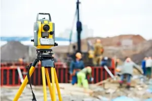
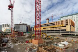
We provide comprehensive construction surveying services including site control, layout staking, and structural verification. Our team supports builders through all phases from initial grading to final as-builts, ensuring dimensional accuracy for foundations, steel frames, and utility infrastructure. We maintain tight tolerances for critical components like anchor bolts and support columns.
Drafting Services
Our drafting division creates detailed land title surveys and construction documents using the latest CAD software. We produce precise plans for easements, plats, and drainage systems that meet regulatory requirements. Our team collaborates closely with clients to ensure drawings align with project specifications and industry standards.
Laser Scanning
We utilize high-speed laser scanning technology to capture 50,000 data points per second for detailed 3D modeling. This advanced method provides unparalleled accuracy for complex terrain mapping and building information modeling (BIM). The resulting point clouds enable precise volume calculations and clash detection for land development projects.
Aerial Surveys
Our UAS (Unmanned Aircraft Systems) surveys employ drones to capture geo-accurate aerial data for large-scale projects. This technology enables efficient topographic mapping, cut/fill volume calculations, and progress monitoring. We integrate drone data with ground surveys to create comprehensive 3D site models for construction planning and documentation.
People
Kevin Hudson
Owner
Kevin founded Hudson Site Control in 1997 with over 20 years of surveying experience. He oversees operations and specializes in construction data modeling. Kevin combines technical expertise with project management skills to ensure client satisfaction.
Mike Cummock
Survey Manager
Licensed in multiple states, Mike brings 25+ years of surveying experience managing industrial and commercial projects. He specializes in pipeline surveys, ALTA standards, and boundary determinations while coordinating with federal agencies.
Ashley January
Sr. Survey Technician
With 19 years of right-of-way engineering experience, Ashley prepares plats, easements, and boundary surveys. She coordinates closely with surveyors to ensure accurate documentation for infrastructure projects.
Jennifer Kuntzman
Accounting/Human Resources
Jennifer has managed financial and HR operations since 2003. She holds a BA in Communications from UT Arlington and ensures smooth administrative operations for the surveying team.
Questions
What types of surveying services do you offer?
We provide boundary surveys, topographical mapping, ALTA/NSPS standards, construction staking, laser scanning, and aerial drone surveys for commercial, municipal, and residential projects.
Do you serve areas outside Dallas-Fort Worth?
While based in Mansfield, we serve all North and East Texas regions including major cities like Dallas, Fort Worth, and Tyler with rapid deployment capabilities.
How do you ensure survey accuracy?
We use advanced total stations, laser scanners, and drones combined with experienced professionals who maintain strict quality control throughout every project phase.
Can you handle large-scale commercial projects?
Yes, we've successfully completed over 2,000 projects including major developments like the Perot Museum and Facebook Data Center with complex surveying requirements.
What makes your company different from other surveyors?
Our combination of 25+ years' experience, cutting-edge technology, rapid response times, and error & omissions insurance provides unmatched reliability and technical expertise.
How do I request surveying services?
Contact us at 817-225-6700 or visit our Mansfield office to discuss your project needs. We'll assign experienced professionals to handle your surveying requirements promptly.
Videos