
Business Details
Professional Land Surveying Services in Dalton, GA
Lowery & Associates Land Surveying is a full-service land surveying firm headquartered in North Georgia, serving clients across the Southeastern United States. With advanced technologies like high-precision GPS and 3D laser scanning, we deliver timely and accurate results for projects of all scales. Our founder, Mitch Lowery, a registered land surveyor with over 12 years of experience, personally oversees every project, ensuring adherence to the highest standards of quality and client satisfaction. We specialize in boundary surveys, topographic mapping, elevation certifications, and erosion control planning, among other services. Licensed in six states, we prioritize responsiveness, transparency, and long-term client relationships.Our team has worked on diverse projects, from residential developments to large commercial pre-development surveys, consistently exceeding client expectations. We are committed to resolving boundary disputes, simplifying permitting processes, and providing data-driven solutions tailored to each client's unique needs. Our reputation for precision and reliability has been built through years of dedicated service and technical expertise. We serve North Georgia counties including Whitfield, Murray, and Walker, as well as parts of Alabama, Tennessee, and other Southeastern states. By combining cutting-edge technology with personalized service, we aim to be the most trusted land surveying partner in the region.
Services
Boundary Surveys
3D Laser Scanning
Elevation Certificates
Topographic Surveys
Residential Site Plans
As-Built Surveys
Erosion Control Plans
ALTA Land Title Surveys
Highlights and features
- We utilize high-precision GPS and 3D laser scanning for unmatched accuracy.
- Founder Mitch Lowery personally oversees all projects with 12+ years of expertise.
- Licensed in six Southeastern states for regional project flexibility.
- Client-focused approach ensures clear communication and timely delivery.
- Proven track record resolving boundary disputes and simplifying permitting processes.
What people say
Accurate and Dependable
Timely and cost-effective
Superior work product
Highest quality plats
No questions left unanswered
Services
Boundary Surveys
Boundary surveys retrace original property lines using courthouse records and field monumentation. They identify encroachments and are essential for resolving disputes or planning new construction. Our surveys ensure legal compliance and clarity for property owners in North Georgia and surrounding states.
3D Laser Scanning
3D laser scanning creates detailed digital models of structures and landscapes. This technology captures millimeter-level accuracy for engineering, architectural, and mechanical projects. It reduces site visits and provides data for inaccessible areas, improving project efficiency and precision.
Elevation Certificates
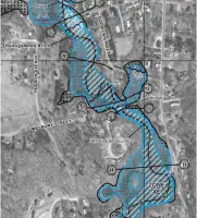
Elevation certificates verify a structure's elevation for flood insurance eligibility. We document critical elevations to determine compliance with FEMA regulations. This service helps property owners avoid unnecessary flood insurance costs by proving structures are above flood zones.
Topographic Surveys
Topographic surveys map natural and man-made features to assess drainage and development potential. They are vital for pre-construction planning, showing elevation changes and existing conditions. Our surveys support infrastructure design and land-use decisions.
Residential Site Plans
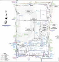
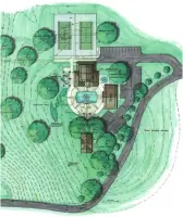
Residential site plans depict existing and proposed improvements for building permits. They include erosion control measures and zoning compliance details. We tailor plans to municipal requirements, ensuring smooth approval processes for homeowners and contractors.
People
Mitch Lowery
Owner & Founder
Mitch Lowery, a registered land surveyor in six Southeastern states, has over 12 years of experience in boundary, topographic, and construction surveys. He personally manages projects from fieldwork to final deliverables, ensuring technical excellence and client satisfaction.
Questions
What areas do you serve?
We serve North Georgia counties including Whitfield, Murray, and Walker, as well as Alabama, Tennessee, Mississippi, North Carolina, and Kentucky.
What services do you offer?
We provide boundary surveys, 3D laser scanning, elevation certificates, topographic surveys, residential site plans, and erosion control plans.
How are elevation certificates used?
Elevation certificates verify a structure's elevation to determine flood insurance eligibility and compliance with FEMA regulations.
Can you help with boundary disputes?
Yes, we conduct boundary surveys to identify property lines and encroachments, resolving disputes through precise measurements and legal documentation.
What technology do you use?
We utilize high-precision GPS and 3D laser scanning for accurate data collection and efficient project completion.