Business Details
27 Years
experience
Trusted Land Surveying Services in Lakeport, CA
Conser Land Surveying has been serving Lake County and surrounding areas since 1999, delivering precise land surveying, planning, and development consulting services. Our team of three licensed surveyors, including two California LS and one Nevada LS, brings over 60 years of combined field and office experience. We serve a diverse clientele, including private landowners, engineering firms, legal professionals, real estate developers, and local municipalities. Our commitment to quality is reflected in our policy that all technical work is performed by certified L.S.I.T.s or licensed land surveyors. We prioritize direct client interaction with licensed professionals for all projects, ensuring accurate guidance from conceptual stages to completion.Our firm maintains strong community ties through affiliations with the California Land Surveyors Association and National Society of Professional Surveyors. We utilize advanced technology to meet evolving client needs across construction sites, rural properties, and residential developments. Our dedication to integrity and professionalism continues the legacy established by founder Michael W. Conser in 1999. We offer free preliminary research and project estimates with no obligation, and guarantee same-day follow-up for all inquiries. This approach has built our reputation as a trusted partner for land solutions in Northern California.
Services
Land Surveying
Boundary Surveys
Topographic Surveys
Construction Staking
ALTA/ACSM Surveys
GPS Surveys
Land Subdivisions
Title Searches
Development Consulting
Boundary Dispute Mediation
Details
- Year established: 1999
Highlights and features
- We have 60+ combined years of land surveying experience in Northern California
- All technical work performed by licensed surveyors or certified professionals
- Direct access to licensed surveyors for all project consultations
- Specialized in Lake County's unique land development requirements
- Guaranteed same-day follow-up for all client inquiries
Services
Land Surveying
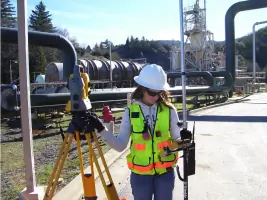
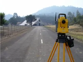
Our comprehensive land surveying services encompass boundary determination, legal descriptions, and mapping for residential, commercial, and industrial properties. We utilize GPS technology and traditional methods to ensure precise measurements that meet California's strict regulatory standards. Our licensed surveyors provide documentation that satisfies both private and public sector requirements for property transactions and development projects.
Boundary Surveys
We conduct detailed boundary surveys to establish or re-establish property lines using historical records and field measurements. Our process includes title research, monumentation, and preparation of official maps that resolve disputes and prevent future encroachments. Clients receive clear documentation for mortgage lenders, title companies, and local government agencies.
Topographic Surveys
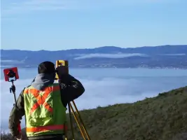
Our topographic surveys capture natural and man-made features to create detailed elevation models for engineering and architectural planning. We use advanced equipment to map contours, vegetation, and structures with high accuracy. These surveys support drainage studies, site development, and environmental impact assessments across diverse terrain types.
Construction Staking
We provide precise construction staking services to guide building placement and infrastructure development. Our surveyors establish reference points for foundations, utilities, and roadways using project plans and local regulations. This ensures proper alignment and compliance with zoning requirements throughout the building process.
ALTA/ACSM Surveys
Our ALTA/ACSM land title surveys meet the rigorous standards required for commercial property transactions. These comprehensive surveys identify easements, encroachments, and improvements that affect title insurance. We collaborate with title companies to deliver detailed maps that satisfy lenders and property buyers during due diligence.
People
Michael S. Conser
Owner, PLS 8383
With 18 years of surveying experience, Michael S. Conser has specialized in Lake County projects for 14 years. He previously worked with Stantec Inc. in Reno, Nevada, and maintains the firm's commitment to integrity established by his father.
Stephen J. Bellah
Project Surveyor, PLS 13383
Stephen Bellah brings over 35 years of surveying experience, including 20+ years with Stantec. A Nevada licensed surveyor since 1998, he contributes extensive project management expertise while preparing for California licensure.
Questions
What land surveying services do you offer?
We provide boundary surveys, topographic mapping, construction staking, ALTA/ACSM surveys, GPS surveys, land subdivisions, and boundary dispute mediation for Lake County properties.
What experience do your surveyors have?
Our three licensed surveyors have over 60 combined years of experience, including specialized work on Lake County projects and Nevada mining operations.
Do you serve areas outside Lake County?
While focused on Lake County, we also serve Mendocino County and surrounding Northern California regions for various land development projects.
What makes your firm different?
All technical work is performed by licensed surveyors or certified professionals, ensuring quality control and regulatory compliance for every project.