
Business Details
Your Trusted Partner for Accurate Land Surveying Services
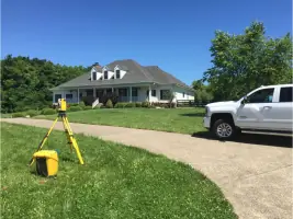
At Century Land Surveying, we have dedicated ourselves to delivering precise and reliable land surveying services across Louisville, Kentucky, and surrounding counties including Oldham and Bullitt. With over 20 years of hands-on experience, Jason Graves, our Professional Licensed Surveyor, has established a reputation for leadership and excellence through his active role in the Kentucky Association of Professional Surveyors. Our client-centered approach ensures direct collaboration with professionals who understand your unique project challenges, eliminating bureaucratic delays. We leverage cutting-edge technology from industry leaders like Trimble and Leica to guarantee accuracy in every survey. By accessing over 200 years of historic survey records from pioneering Louisville firms such as Merritt Drane and Rodgers & Rodgers, we provide unmatched historical context for complex projects.Our commitment to quality ensures every project is completed correctly the first time, supporting hundreds of clients annually with boundary surveys, ALTA surveys, topographic mapping, and more. Fully insured with professional, general, and workers' compensation coverage, we combine technical expertise with personalized service to meet the exact needs of homeowners, developers, and commercial property owners. Our proven track record of delivering precise data for construction layouts, easement retracing, and flood certification has made us Louisville's preferred choice for professional land surveying services.
Services
Boundary Surveys
Mortgage Inspections
ALTA Surveys
Topographic Mapping
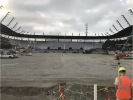
Construction Layout
Easement Retracing
Flood Certificates
Land Division
Highlights and features
- We offer over 20 years of licensed surveying experience with industry leadership.
- Our team provides direct, one-on-one service with no bureaucratic layers.
- We utilize Trimble and Leica GPS technology for maximum survey accuracy.
- We access 200+ years of Louisville's historic survey records for enhanced precision.
- Fully insured with professional liability, general liability, and workers' compensation coverage.
Services
Boundary Surveys
Our boundary surveys determine precise property dimensions and corners using historical records and modern technology. This service helps resolve disputes, supports property transactions, and guides construction projects. Clients receive legally defensible documentation for court use or land transfers.
ALTA Surveys
ALTA/ACSM surveys meet strict lender requirements for commercial property transactions. We follow standardized specifications to deliver detailed maps showing boundaries, easements, and improvements. This service ensures compliance with title insurance requirements and minimizes legal risks for developers and businesses.
Topographic Mapping
Topographic surveys create detailed maps of terrain features, elevations, and existing structures. This service supports construction planning, drainage analysis, and environmental assessments. We combine GPS data with traditional surveying methods to produce accurate elevation models for engineering and architectural projects.
Construction Layout
Our construction layout service marks precise locations for buildings, roads, and utilities based on architectural plans. This ensures proper alignment and compliance with permits. We work closely with contractors to maintain accuracy throughout the development process, reducing costly rework.
Flood Certificates
Flood elevation certificates determine if properties fall within FEMA-designated flood zones. This service helps homeowners and lenders assess flood risk and obtain appropriate insurance. We provide certified documentation required for mortgage approvals and floodplain management compliance.
People
Jason Graves
Professional Licensed Surveyor
With over 20 years of experience, Jason Graves leads Century Land Surveying as a licensed surveyor. He previously served as President of the Kentucky Association of Professional Surveyors, demonstrating industry leadership. His expertise in historical records and modern technology ensures accurate results for complex projects.
Questions
What services does Century Land Surveying offer?
We provide boundary surveys, ALTA surveys, topographic mapping, construction layout, easement retracing, flood certificates, and land division services for residential and commercial clients.
Why choose Century Land Surveying for property surveys?
Our 20+ years of experience, use of Trimble and Leica GPS technology, and access to 200+ years of Louisville survey records ensure precise, reliable results tailored to client needs.
Do you serve areas outside Louisville?
We primarily serve Louisville, Kentucky, along with Oldham and Bullitt counties, providing accurate surveying solutions for local residential and commercial projects.
How are survey costs determined?
Each survey is researched individually, with quotes based on site complexity, required historical record access, and project-specific requirements to ensure accurate pricing.
Are your surveyors licensed and insured?
Yes, we maintain professional liability, general liability, and workers' compensation insurance. Our lead surveyor holds active Kentucky licensing credentials.
Can you help with commercial property surveys?
We specialize in ALTA surveys for commercial transactions, providing detailed documentation that meets lender requirements and title insurance standards for business properties.