Business Details
42 Years
experience
Professional Land Surveying Services in Whatcom County
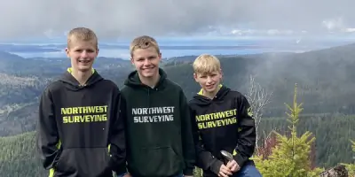
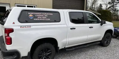
Northwest Surveying & GPS Inc. is a full-service land surveying company founded on the principle that successful projects require a strong, energized team led by clear communication and competent professionals. Established in 1984 by Denny DeMeyer, a lifelong Whatcom County native, the company transitioned to his son Jeromy in 2013, maintaining its commitment to local expertise and quality service. With over 37 years of experience, the firm has completed 3,300+ boundary surveys and 250+ short plats, leveraging the latest technology and a hands-on approach to meet client needs.Our team combines 56+ years of collective experience with a focus on personal service, ensuring timely communication and project completion from conception to execution. We adhere to the highest ethical standards and industry practices, prioritizing client satisfaction through accurate, reliable surveying solutions tailored to both public and private sector demands.
Services
Boundary Surveys
Short Subdivisions
FEMA Floodplain Removal
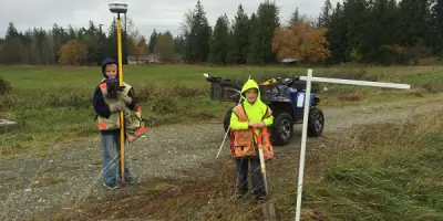
Construction Staking
Topographic Surveys
ALTA Surveys
Gravel Pit Reclamation
Easement Preparation
Wetland Mapping
Condominium Services
Details
- Year established: 1984
Highlights and features
- 37 years of local land surveying expertise in Whatcom County
- Completed 3,300+ boundary surveys and 250+ short plats
- Utilize state-of-the-art GPS and mapping technology
- Hands-on approach with direct client communication
- Licensed professionals with 56+ years of combined experience
What people say
Excellent work
Quick and professional
Highly recommended
Super friendly
Cost-effective solutions
Services
Boundary Surveys
Our boundary surveys establish precise property lines using historical records and field measurements. Clients benefit from 37 years of local expertise, ensuring compliance with zoning regulations and minimizing legal disputes. Services include title certificate reviews, easement documentation, and GPS-based boundary verification.
FEMA Floodplain Removal
We specialize in FEMA LOMA/LOMR applications to remove properties from flood hazard areas. Our process includes elevation analysis and documentation submission, reducing insurance costs and improving property usability while adhering to federal mapping standards.
Topographic Surveys
Our topographic surveys map natural and man-made features with elevation data. This critical information supports construction planning, drainage projects, and regulatory compliance, using advanced GPS technology for high-accuracy results.
Construction Staking
We provide precise construction staking to guide building projects according to design plans. Our services ensure proper placement of structures, roads, and utilities, preventing costly errors during development phases.
Gravel Pit Reclamation
Our reclamation services restore gravel pits to functional landscapes using cost-effective methods. We develop sustainable solutions that meet environmental regulations while preparing sites for future use.
People
Jeromy M. DeMeyer
Owner/Manager
Licensed Professional Land Surveyor with 28 years of experience. Graduated from Lynden High School in 1995, obtained his license in 2013, and purchased the company in 2013. Specializes in boundary analysis and GPS technology.
Brett DeVries
Professional Land Surveyor
Licensed since 2012 with expertise in survey calculations and CAD drafting. Joined the company in 1998, bringing extensive experience in research, field operations, and technical documentation to client projects.
Dale L. Sharp
GPS Technician
Field operations specialist with 34 years of experience. Started as a chain man in 1990, advancing to party chief. Responsible for field safety, data collection, and implementation of surveying technology.
Dennis M. DeMeyer
Boundary Consultant
Retired founder with 44 years of surveying experience. Honored as Washington State Surveyor of the Year, providing mentorship and boundary expertise to the team since 1984.
Heather Mussard
Office Manager
CAD technician and office manager with expertise in technical documentation. Joined in 2015, managing administrative operations while supporting surveying projects through digital mapping and client communication.
Questions
How do I start a boundary survey process?
Contact us to schedule a consultation. We'll review property records, conduct field measurements, and provide a detailed report of your property boundaries.
Can you help remove my property from a FEMA flood zone?
Yes, we prepare LOMA/LOMR applications with elevation data to challenge flood zone designations and reduce insurance requirements.
What areas do you serve?
Primarily Whatcom County, WA, with additional projects throughout the Pacific Northwest region.
What surveying technologies do you use?
We employ GPS, GIS, and conventional theodolite equipment for accurate data collection and mapping.
How quickly can you complete a survey?
Turnaround varies by project scope, but we prioritize urgent requests and have completed boundary adjustments in two weeks.
Do you handle commercial and residential projects?
Yes, we serve both sectors with services ranging from subdivision plats to construction staking for homes and commercial developments.