
Business Details
19 Years
experience
Expert Land Surveying Services in Arcata, CA
Points West Surveying was established in 2007 to address the growing specialization within the land surveying profession. Our company was founded by David A. Crivelli and Michael D. Pulley, who have collaborated for over 25 years, with Jesse N. Buffington joining as co-owner in 2022 after 14 years of service. We specialize in delivering high-quality surveying solutions to both public and private clients, including engineering firms that rely on our expertise for their surveying needs. Our public sector clients span multiple cities and counties along California's North Coast, where we have maintained a strong reputation for accuracy and reliability even during economic downturns. With a team of eight professionals, including three licensed surveyors, we utilize advanced equipment such as Leica robotic total stations and Topcon HiPer V RTK GPS systems to ensure precision.Our commitment to exceeding client expectations has resulted in long-term partnerships and a steady flow of repeat business. We maintain full compliance with state and federal project requirements, including Prevailing Wage and Davis-Bacon standards. Our investment in cutting-edge technology, combined with our staff's extensive experience, allows us to deliver timely and budget-conscious solutions for projects of all sizes. Regular participation in continuing education ensures our team remains at the forefront of surveying advancements. This dedication to excellence has enabled us to successfully complete complex projects like the Mad River Parallel Pipeline survey, which earned industry recognition for innovative methodology.

Services
Boundary Surveys
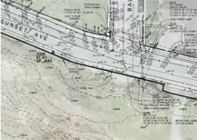
Topographic Mapping
Construction Staking
Subdivisions
ALTA Surveys
GPS Control Surveys
Hydrographic Surveys
Aerial Mapping
Flood Certificates
Easements
Details
- Year established: 2007
Highlights and features
- We have over 25 years of combined experience in land surveying
- We utilize state-of-the-art Leica and Topcon GPS equipment
- Our team includes three licensed surveyors and eight dedicated professionals
- We ensure compliance with state and federal project requirements
- We deliver timely and accurate surveys within deadlines
Services
Boundary Surveys
Our boundary surveys precisely define property lines using historical research and modern GPS technology. We restore historic monuments and resolve disputes through accurate measurements. Clients receive detailed documentation for legal and development purposes.
Construction Staking
We provide precise construction staking for infrastructure projects using robotic total stations. Our work ensures accurate placement of buildings, roads, and utilities. Contractors receive clear stakeout data for efficient project execution.
Topographic Mapping
Our topographic surveys create detailed elevation models using advanced survey equipment. These maps support engineering design and environmental assessments. Clients receive accurate digital terrain models for project planning.
ALTA Surveys
We conduct ALTA/NSPS standard surveys for commercial property transactions. Our surveys meet title insurance requirements with boundary, easement, and improvement details. Clients receive comprehensive documentation for real estate deals.
Hydrographic Surveys
Our hydrographic surveys map underwater features using specialized equipment. These surveys support coastal engineering and environmental studies. Clients receive accurate bathymetric data for waterfront projects.
People
Michael D. Pulley
President and Co-Owner
With 27+ years of experience, Michael leads survey projects and provides quality control. He specializes in historical record research and has served as expert witness in court cases. Active in CLSA leadership.
Jesse N. Buffington
Vice-President and Co-Owner
Licensed surveyor with 16 years of experience, Jesse manages complex boundary surveys and county projects. He specializes in historic monument restoration and has led Humboldt County storm damage site surveys for 14 years.
David A. Crivelli
Co-Founder
37-year industry veteran who led major infrastructure projects including the Mad River Pipeline. Expert in all survey aspects from GPS control to construction staking. Recipient of CELSOC Honor Award for innovative survey methods.
Bill Pool
CAD Drafter
25-year drafting expert creates accurate digital terrain models and survey maps. His work ensures clear data presentation for engineering projects. Proficient in Civil 3D software for precise documentation.
Ryan Baxter
Field Surveyor
16-year field and office surveyor skilled in robotic total stations and GPS equipment. Handles construction surveys and stakeout data preparation. Provides technical expertise for both field and drafting tasks.
Questions
What types of land surveying services do you offer?
We provide boundary surveys, construction staking, topographic mapping, ALTA surveys, hydrographic surveys, and GPS control surveys using advanced equipment.
How experienced is your surveying team?
Our team includes three licensed surveyors with 16-37 years of experience, supported by five field and CAD professionals using state-of-the-art technology.
Do you handle government-funded projects?
Yes, we comply with Prevailing Wage, Davis-Bacon, and federal requirements for state and federally funded projects, including certified payroll documentation.
What surveying technology do you use?
We utilize Leica robotic total stations, Topcon HiPer V RTK GPS systems, and Civil 3D software for accurate data collection and mapping.
How quickly can you complete a survey project?
With four field crews and advanced equipment, we complete projects within deadlines while maintaining accuracy, adapting schedules to meet client timelines.