
Business Details
43 Years
experience
Professional Land Surveying Services in Bloomington, MN
Founded in 1983, W. Brown Land Surveying has served the Twin Cities and surrounding areas for over four decades. Our team combines deep local expertise with advanced technology to deliver precise land surveying solutions tailored to residential, commercial, and municipal needs. With decades of collective experience, we specialize in cadastral surveys, ALTA/NSPS standards, and complex land subdivisions, ensuring compliance with evolving regulations.Our service-oriented approach prioritizes client collaboration, from initial site plans to construction staking, guaranteeing accuracy and reliability. Led by founder Woodrow 'Woody' Brown, our professionals bring technical excellence and integrity to every project, maintaining a legacy of trust in the communities we serve.
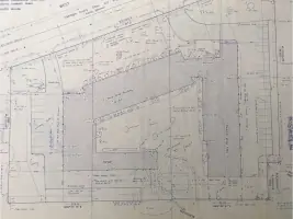
Services
Cadastral Surveys
Permitting Surveys
ALTA/NSPS Surveys
Land Subdivision
Site Plans
Construction Staking
Details
- Year established: 1983
Highlights and features
- We have over 40 years of Twin Cities land surveying experience.
- Our team specializes in ALTA/NSPS standard surveys for property sales.
- We streamline municipal permitting with detailed, compliant surveys.
- Our precise construction staking prevents costly placement errors.
- We maintain a legacy of client-focused service since 1983.
Services
Cadastral Surveys
Cadastral surveys precisely determine property boundaries for fence installations, shed placements, or legal documentation. Our team uses advanced equipment to map exact limits, preventing neighbor disputes. Clients receive clear, legally compliant records for peace of mind in residential and commercial projects.
ALTA/NSPS Surveys
ALTA/NSPS surveys meet national standards for property sales, showing buildings, driveways, and improvements. These detailed maps satisfy title insurance requirements and lender mandates. Our certified surveys ensure transparency in real estate transactions across the Twin Cities region.
Construction Staking
Construction staking marks precise locations for buildings, utilities, or improvements. Our GPS-guided equipment ensures accurate placement, minimizing costly errors. This service streamlines project starts for contractors while maintaining alignment with approved plans and zoning regulations.
Land Subdivision
Land subdivision services handle administrative splits, recorded plats, and PLSS divisions. We navigate municipal requirements to create new lot configurations. Clients benefit from seamless transitions through complex legal and technical processes for residential or commercial development.
Permitting Surveys
Permitting surveys document existing conditions required for building approvals. Our team understands Twin Cities regulations to expedite permit acquisition. Accurate data presentation ensures compliance with zoning laws, reducing delays for residential and commercial construction projects.
People
Woodrow "Woody" Brown
Founder, President, Professional Land Surveyor
With over 60 years in surveying since 1962, Woody established W. Brown Land Surveying in 1983. His expertise spans thousands of Twin Cities projects, ensuring technical excellence and client satisfaction through decades of hands-on experience.
Chad Elvin
Lead CAD Draftsman
Chad joined the team in 2005, developing expertise in field work and CAD drafting. He creates clear, detailed site plans and construction documents, combining technical precision with practical insights gained from 18 years of Twin Cities surveying projects.
Matt Brown
Senior Crew Chief
Matt has collaborated with Woody for decades, managing field operations and survey drafting. His dual role ensures seamless integration of field data collection and office-based analysis, maintaining accuracy across complex land surveying assignments in the Twin Cities region.
Joe Norgaard
Senior Crew Chief
Bringing 20+ years of surveying experience since joining in 2021, Joe leads field crews with technical proficiency. His expertise in data acquisition and team management enhances project efficiency while maintaining strict adherence to ALTA/NSPS and municipal standards.
Tyler Stanley
Junior Crew Chief
Tyler joined in 2021, rapidly advancing to crew leadership under Joe's mentorship. He demonstrates professional competence in field operations, applying modern surveying techniques to deliver accurate data for boundary determinations and construction projects across Minnesota.
Questions
What types of land surveys do you specialize in?
We specialize in boundary surveys, ALTA/NSPS standards for property sales, construction staking, land subdivisions, and permitting surveys tailored to Twin Cities regulations.
How do you ensure survey accuracy?
We use GPS-guided equipment and follow national standards. Our 40+ years of experience combined with modern technology guarantees precise measurements for all residential and commercial projects.
Can you help with municipal permit requirements?
Yes, we prepare detailed surveys meeting local zoning codes and provide documentation required for building permits across all Twin Cities jurisdictions.
What information should I provide before a survey?
Share property deeds, existing plats, and project goals. This helps us determine boundary history and specific requirements for your surveying needs.
How long does a typical survey take?
Most residential surveys complete within 1-3 days. Complex commercial projects or subdivisions may require additional time depending on site conditions and regulatory requirements.