Business Details
41 Years
experience
Expert Land and Hydrographic Survey Services in Florida
Founded in 1985, Morgan & Eklund has built a reputation as a trusted provider of land and hydrographic survey services across Florida. Our team of four registered land surveyors, three survey crews, and two hydrographic survey crews combines decades of experience with state-of-the-art technology to deliver accurate and reliable data. Specializing in boundary, topographic, GPS, and hydrographic surveys, we support critical infrastructure projects, beach restoration efforts, and large-scale water management initiatives. Our integration with sister company CSA Ocean Sciences Inc. expands our capabilities to include geophysical and oceanographic services, ensuring comprehensive solutions for engineering firms, government agencies, and construction contractors. With over 40 years of experience and a commitment to quality control, we consistently meet project deadlines while maintaining adherence to Florida Minimum Technical Standards, USACE survey standards, and Federal Geodetic Control Commission Standards.Our investment in cutting-edge tools like autonomous surface vehicles (ASVs) and UAVs underscores our dedication to innovation, safety, and cost-effective data collection. Clients including the U.S. Army Corps of Engineers and Floridas coastal counties rely on our expertise for projects ranging from Everglades restoration to port improvements. Our legacy of excellence, rooted in founder John Morgans pioneering work since 1978, continues through a team dedicated to professional integrity and timely delivery of results.
Services
Hydrographic Surveys
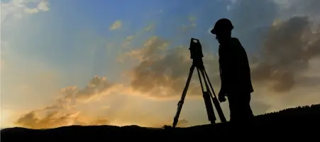
Topographic Surveys
GPS Surveys
Computer-Aided Drafting
Autonomous Remote Surveys
Details
- Year established: 1985
Highlights and features
- We have 40+ years of experience in land and hydrographic surveying across Florida.
- Our team includes four registered land surveyors and specialized crews with advanced training.
- We utilize state-of-the-art technology including autonomous surface vehicles and UAVs.
- We maintain strict quality control under Florida and federal surveying standards.
- Our partnership with CSA Ocean Sciences Inc. expands our geophysical capabilities.
Services
Hydrographic Surveys
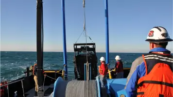
We conduct hydrographic surveys using single beam, multibeam, and side scan sonar to map underwater terrain. Our services support dredging projects, beach erosion analysis, and port improvements by providing bathymetric data and sediment depth mapping. With 40 years of experience, we deploy advanced equipment like ADCP current profilers and magnetometers to ensure precise measurements for coastal infrastructure and environmental monitoring.
Topographic Surveys
Our topographic surveys include beach profiles, canal cross-sections, and digital terrain modeling using RTK/GPS and automated data collection. We serve government agencies and engineering firms by creating detailed elevation models for levee restoration, Everglades projects, and floodplain management. Our team adheres to Florida and federal standards, ensuring accuracy for engineering design and construction planning in diverse environments.
GPS Surveys
We provide static, fast static, and real-time kinematic (RTK) GPS surveys for control networks and boundary delineation. Using Trimble Business Center software, we process data for engineering projects requiring high-precision geodetic measurements. Our expertise includes integrating GPS with conventional surveying methods to support large-scale infrastructure projects and photogrammetry applications under AEC compliance standards.
Computer-Aided Drafting
Our CAD team converts survey data into actionable visualizations using AutoCAD Civil 3D, ArcGIS, and Bentley software. We create digital terrain models and engineering drawings for coastal projects, ensuring seamless integration of bathymetric and topographic data. With 36+ years of experience, we deliver precision drafting solutions that support decision-making for planners, engineers, and environmental agencies.
Autonomous Remote Surveys
We deploy autonomous surface vehicles (ASVs) and UAVs for efficient data collection in challenging environments. These systems reduce operational costs and human risk while improving accuracy for coastal and underwater surveys. Our WingtraOne UAV captures aerial LiDAR and photogrammetry data, complementing ASV-based bathymetric surveys to provide comprehensive datasets for large-scale infrastructure and environmental projects.
People
David W. Coggin
Vice President
Co-founder with 46+ years of surveying experience, overseeing daily operations and hydrographic projects. Expert in marine logistics and coastal surveys, ensuring quality control and client satisfaction through decades of Florida-based infrastructure support.
Chris A. Gammon
Project Manager
42-year veteran managing boundary and geodetic surveys using conventional and GPS technologies. Proficient in CAD software and AEC standards, delivering precise data for engineering and construction projects across Floridas coastal regions.
Paul C. Voute
Field Supervisor
Seasoned field supervisor with expertise in land and hydrographic surveys. Trained in RTK/GPS and total station operations, leading coastal monitoring projects and ensuring adherence to technical standards for over 30 years.
Matt A. Barker
Field Supervisor
32-year surveying professional specializing in beach nourishment and geodetic surveys. Trains field crews and operates survey vessels, combining technical proficiency with safety-focused practices for complex coastal projects.
Don Donaldson
Hydrographic Project Manager
13-year hydrographic surveyor recently promoted to manager. Skilled in Hypack/Qimera software and field troubleshooting, conducting dredging and environmental surveys while advancing autonomous data collection techniques for improved project efficiency.
Questions
What types of survey services does Morgan & Eklund offer?
We specialize in hydrographic, topographic, GPS, and computer-aided drafting services, with autonomous remote survey capabilities.
How long has Morgan & Eklund been in business?
We were founded in 1985 and have provided survey services in Florida for over 40 years.
What technology does Morgan & Eklund use?
We use RTK/GPS, multibeam sonar, UAVs, ASVs, and CAD software like AutoCAD Civil 3D for precise data collection and modeling.
Which clients does Morgan & Eklund work with?
We serve government agencies, engineering firms, and construction contractors including the U.S. Army Corps of Engineers and Florida water management districts.
Where does Morgan & Eklund operate?
We primarily work in Florida, supporting projects in coastal counties from Miami-Dade to St. Johns.