
Business Details
42 Years
experience
Trusted Land Surveying and Engineering Services in Emporia, KS
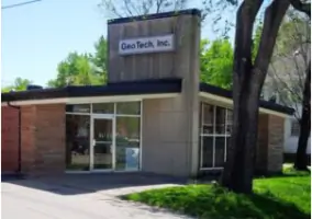
Geotech has been a trusted provider of land surveying and engineering services since 1984, serving the Emporia and Flint Hills area. With over 43 years of combined experience, our team combines ancient surveying principles with modern technology to deliver precise and reliable results. We specialize in boundary surveys, construction staking, and floodplain analysis, catering to public and private sectors including attorneys, contractors, and lenders. Our expertise spans Chase, Coffey, Greenwood, Lyon, Marion, Morris, and Osage Counties, where we maintain a reputation for tailored solutions and meticulous attention to detail.We prioritize client collaboration, ensuring services align with specific project needs while adhering to legal and technical standards. Our commitment to quality is reflected in our extensive recording of surveys for client protection and our role as a trusted partner in land transactions. As an industry leader, we contribute to professional education and community development, maintaining active involvement in local and state surveying organizations.

Services
Boundary Surveys
Construction Staking
Elevation Certificates
ALTA Surveys
Lot Splits
Topographic Surveys
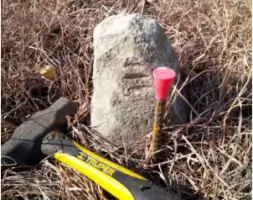
Monument Searches
Quantity Determinations
Monitoring Wells
Floodplain Analysis
Details
- Year established: 1984
Highlights and features
- We offer 43 years of combined experience in land surveying and engineering.
- Our team uses modern technology while adhering to ancient surveying principles.
- We specialize in tailored solutions for attorneys, contractors, and property owners.
- All boundary surveys are recorded in the Register of Deeds for client protection.
- Our expertise covers six Kansas counties with in-depth local knowledge.
Services
Boundary Surveys
Our boundary surveys establish precise property lines using historical records and modern GPS technology. We combine legal research with field measurements to resolve disputes and ensure compliance with Kansas statutes. Clients receive detailed documentation for recording in the Register of Deeds.
Construction Staking
We provide accurate staking for commercial and industrial sites in Emporia. Our team uses CAD modeling to optimize building placement and ensures foundation layouts meet code requirements for efficient inspections.
Elevation Certificates
Our elevation certificates determine flood risk for insurance purposes. We measure structures against FEMA flood maps and assist with LOMA applications to potentially reduce flood insurance premiums.
ALTA Surveys
ALTA surveys meet national standards for commercial property transactions. We identify easements, encroachments, and legal descriptions to satisfy title insurance requirements and minimize transaction risks.
Lot Splits
We handle lot splits from initial planning to final plat recording. Our process ensures compliance with local zoning laws and includes topographic analysis to maintain usability of divided parcels.
People
Steven S. Brosemer
Owner, Retired
With surveying experience since 1979, Steven Brosemer founded Geotech, Inc. in 1984 and served as Kansas State Board of Technical Professions member. He now teaches at Kansas City Kansas Community College.
Aaron C. Davis
Office Manager
Licensed surveyor with 25+ years of experience, Aaron specializes in construction staking and CAD drafting. He leads the Kansas Society of Land Surveyors as current president and serves as township treasurer.
Beth Higgins
Project Coordinator
Beth manages client projects with 25 years of surveying expertise. She combines field experience with office support to ensure smooth project execution and client communication.
Questions
What services does Driggs Design Group offer?
We provide boundary surveys, construction staking, elevation certificates, ALTA surveys, lot splits, and other land surveying services for residential, commercial, and public projects.
Why should I get a survey before buying land?
A professional survey verifies property boundaries, identifies easements, and prevents disputes. It's crucial for accurate title insurance and avoiding costly surprises after purchase.
How are survey costs determined?
Survey fees depend on property size, complexity, and required research. We provide estimates after evaluating your specific needs during initial consultation.
Do you work outside Lyon County?
We serve Chase, Coffey, Greenwood, Lyon, Marion, Morris, and Osage Counties with specialized knowledge of local regulations and terrain characteristics.
Can you help with flood insurance requirements?
Yes, we prepare elevation certificates and LOMA applications to determine flood risk and potentially reduce insurance premiums for property owners.