
Business Details
20 Years
experience
Your Trusted Partner for Construction Surveying Solutions
At Straub Surveying, we understand the critical importance of precision and timeliness in construction projects. With over 20 years of experience serving Ohio, our team delivers reliable surveying and layout services tailored to both commercial and residential needs. We specialize in high-definition 3D laser scanning, boundary surveys, and construction layout, ensuring accuracy from initial planning to final execution. Our commitment to transparency is reflected in our flexible pricing models, including fixed fees and hourly rates, designed to eliminate budget surprises. By maintaining close collaboration with clients throughout every project phase, we ensure alignment with expectations while leveraging cutting-edge technology like Leica C-10 and BLK360 laser scanners.Our expertise extends to volume takeoffs, site preparation, and 3D machine control files, supporting contractors with efficient GPS-guided operations. With three survey crews boasting 80 combined years of experience, we provide dependable solutions for complex projects ranging from educational institutions to hazardous waste areas. Our dedication to quality control and client communication has established us as a trusted partner in northern Ohio's construction industry since 2006.
Services
3D Laser Scanning
Construction Layout
Boundary Surveys
Topographic Surveys
As-Built Surveys
Site Preparation
Volume Takeoffs
Machine Control Files
Elevation Certificates
ALTA/ACSM Surveys
Details
- Year established: 2006
Highlights and features
- We offer fixed-fee pricing options for transparent budgeting
- Our team has over 20 years of experience in construction surveying
- We utilize high-definition 3D laser scanning technology for accuracy
- We maintain close client collaboration throughout all project phases
- Our three survey crews have 80 combined years of field experience
Services
3D Laser Scanning
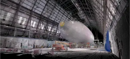
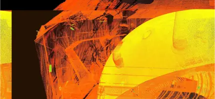
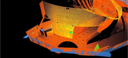
Our high-definition 3D laser scanning captures millions of data points for accurate site mapping. Using Leica C-10 and BLK360 scanners with 300-meter range, we create detailed point clouds and 3D models for construction projects, hazardous areas, and crime scenes. This technology enables precise measurements from safe distances while producing files compatible with AutoCAD, Revit, and BIM software.
Construction Layout
We provide precise building layout services for educational and commercial projects. Our experienced crews perform quality control surveys to verify other contractors' work, ensuring structural elements align with plans. With over 60 completed educational projects since 2006, we maintain strict tolerances for foundation placements, steel columns, and site improvements.
As-Built Surveys
Our as-built surveys document completed construction elements including anchor bolts, building pads, and site improvements. These surveys verify compliance with design specifications before steel erection or grading completion. We provide detailed documentation for quality assurance and future maintenance reference.
Boundary Surveys
We conduct boundary surveys for residential and commercial properties, including lot splits and elevation certifications. Our services identify property lines, easements, and encroachments to prevent legal disputes. We provide certified documentation for real estate transactions and development projects.
Machine Control Files
We create 3D machine control files for Topcon, Trimble, and Leica systems to optimize construction efficiency. These files guide GPS-equipped equipment for accurate grading and excavation. Our virtual design checks prevent field errors and minimize equipment downtime during roadway and site development projects.
Questions
What construction surveying services do you offer?
We provide 3D laser scanning, construction layout, boundary surveys, as-built documentation, topographic surveys, and machine control files for commercial and residential projects.
Do you work on educational facility projects?
Yes, we've completed construction layout for over 60 educational projects in northern Ohio since 2006, including colleges, high schools, and intermediate schools.
How do you ensure project accuracy?
We use high-definition 3D laser scanning and perform quality control surveys to verify work. Our three survey crews have 80 combined years of field experience ensuring precise measurements.
Can you handle large-scale commercial projects?
Yes, we excel at both small and large commercial projects, providing services from initial layout to final as-built documentation with transparent pricing options.
What technology do you use?
We utilize Leica C-10 and BLK360 laser scanners, GPS machine control systems, and BIM-compatible software to deliver accurate survey data and construction documentation.