Business Details
38 Years
experience
Expert Land Surveying Services in Sparta, NJ
Founded in 1988, Louis J Weber & Associates has established itself as a leading surveying firm in the tri-state area. Our expertise spans construction, boundary, and topographic surveying, supported by certifications and licenses across multiple states. With veteran surveyors and highly skilled staff, we deliver precision and reliability for projects ranging from small-scale boundary assessments to large infrastructure developments. Our team utilizes advanced technologies, including GPS and photogrammetry, to ensure accuracy in every project.We maintain rigorous quality control processes to minimize errors and maximize efficiency, serving clients such as state agencies, municipalities, architects, and environmental specialists. Our commitment to continuous education and safety certifications ensures access to diverse project sites, including hazardous environments. Affiliated with industry unions and consistently expanding our capabilities, we prioritize client trust through transparent communication and results-driven solutions.
Services
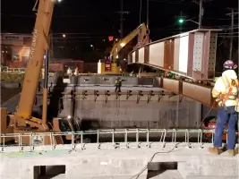
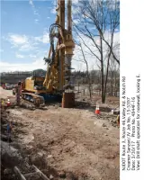
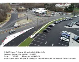
Construction Surveying
Boundary Surveys
Topographic Mapping
Photogrammetry
GPS Surveys
Wetlands Mapping
As-Built Surveys
Utility Easement Surveys
Details
- Year established: 1988
Highlights and features
- We offer 35+ years of experience in land surveying since 1988.
- Our team includes veteran surveyors with advanced technical certifications.
- We utilize cutting-edge GPS and photogrammetry technologies for accuracy.
- Our quality control processes minimize errors and project delays.
- We serve diverse clients including state agencies and environmental specialists.
Services
Construction Surveying
Our construction surveying ensures precise project execution through high-order control networks and machine guidance systems. We recover existing monuments and verify field data using advanced equipment to prevent costly errors during development. Our team supports large-scale infrastructure projects with real-time GPS monitoring.
Boundary Surveys
We conduct legally compliant boundary surveys using total stations and GPS technology to resolve land ownership disputes. Our ALTA/ACSM-certified surveys meet title insurance requirements while addressing complex legal and geometric considerations for urban and rural properties.
Topographic Mapping
Our topographic surveys create detailed elevation models for engineering and environmental planning. Using aerial photogrammetry and hydrographic tools, we map terrain features, wetlands, and subsurface utilities to support construction and ecological assessments across three states.
Photogrammetry
We utilize advanced digital aerial imagery systems to produce orthophotos and 3D models for route surveys and volume calculations. This technology enables efficient data collection over large areas while maintaining compatibility with engineering design software.
GPS Surveys
Our GPS surveying services provide centimeter-level accuracy for control networks and deformation monitoring. Real-time kinematic systems allow rapid data collection in challenging environments, supporting both construction layout and long-term infrastructure assessment projects.
People
Louis J. Weber
President
Founder Louis J. Weber has over 40 years of surveying experience, starting with the US Forest Service in 1977. He holds professional licenses in land surveying and planning, maintaining active involvement in industry education through seminars and workshops.
Questions
What types of surveying services do you offer?
We specialize in construction, boundary, topographic, photogrammetry, GPS, wetlands mapping, as-built, and utility easement surveys.
How long has your company been in business?
Louis J. Weber and Associates has provided surveying services since 1988, with over 35 years of industry experience.
What technology do you use for surveys?
We employ advanced GPS systems, photogrammetry, and real-time data verification tools for precise results.
Do you work with both public and private clients?
Yes, we serve state agencies, municipalities, corporations, realtors, attorneys, and individual property owners.
How do you ensure survey accuracy?
Our rigorous quality control network and experienced field crews minimize errors during data collection and analysis.
Can you handle complex environmental surveys?
Yes, we conduct wetlands mapping, hazardous material assessments, and subsurface utility surveys with specialized equipment.