Business Details
25 Years
experience
Your Trusted Land Surveying Partner in Central New York
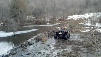
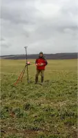
Founded in 2001, SeGuin Land Surveying has established itself as a trusted provider of comprehensive land surveying services across Central New York. Our team leverages cutting-edge technology, including GPS and robotic total stations, to deliver precise and efficient data collection from fieldwork to project completion. With decades of combined experience, we serve property owners, legal professionals, contractors, and government agencies, offering tailored solutions that meet diverse surveying needs. Our commitment to accuracy is reinforced by access to over 75 years of historical survey records from multiple regional firms. We maintain full insurance coverage, including professional liability and workers' compensation, to ensure client confidence.Our expertise spans boundary surveys, construction layout, FEMA flood certifications, and ALTA/ACSM land title surveys. We collaborate with a network of professionals for specialized services like wetland delineation and 3D laser scanning. Our founder, Forrest L. SeGuin, brings extensive industry knowledge from his 30+ year career and active participation in professional organizations. We prioritize continuing education to stay at the forefront of evolving surveying standards. Our mission is to provide reliable, cost-effective surveying solutions that meet project deadlines while maintaining the highest quality benchmarks.
Services
ALTA/ACSM Land Title Surveys
Boundary Surveying
Construction Layout
FEMA Flood Surveys
Mortgage Surveys
Topographic Design
Subdivision Planning
Wetland Delineation
3D Laser Scanning
Septic System Design
Details
- Year established: 2001
Highlights and features
- We offer 20+ years of local surveying expertise since 2001
- Our team utilizes GPS and robotic total stations for maximum accuracy
- Access to 75+ years of historical survey records from Central New York firms
- Comprehensive service range from boundary surveys to 3D modeling
- Fully insured with professional liability and workers' compensation coverage
Services
ALTA/ACSM Land Title Surveys
ALTA/ACSM Land Title Surveys provide comprehensive commercial property surveys meeting national standards. These surveys require title commitments and documents to create detailed boundary maps for lending and insurance purposes. Our team delivers precise documentation tailored to specific transaction requirements.
Boundary Surveying
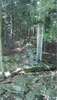
Boundary surveying establishes accurate parcel lines using deed descriptions and field evidence. We apply boundary laws to determine property limits and set permanent markers with licensed identification. This service resolves disputes and clarifies land ownership for development purposes.
Construction Layout
Construction layout services provide precise markings for building projects using GPS and conventional instruments. We customize stakeout solutions with elevation data for grading and foundation work. Our support includes topographic modeling and GPS machine control preparation.
FEMA Flood Surveys
FEMA flood surveys determine property risk through elevation certificates and LOMA documentation. We prepare required forms for flood insurance rating and coordinate with FEMA's eLOMA system. Services include elevation verification and floodplain removal documentation.
Mortgage Surveys
Mortgage surveys create property maps showing buildings and improvements relative to boundary lines. These surveys identify encroachments and zoning issues for real estate transactions. Commonly used by lenders, attorneys, and title companies during property transfers.
People
Forrest L. SeGuin
Founder / Licensed Land Surveyor
Forrest SeGuin founded the firm in 2001 after 14 years of surveying experience. Licensed since 1999, he combines community involvement with technical expertise from Chicago engineering firms. Active in professional associations and local youth programs.
Questions
What geographic areas do you serve?
We provide land surveying services throughout Central New York, including Syracuse, Onondaga County, Madison County, Oneida County, Oswego County, and Cayuga County.
What types of surveying services do you offer?
Our services include ALTA/ACSM land title surveys, boundary surveys, construction layout, FEMA flood certifications, mortgage surveys, topographic design, subdivision planning, and wetland delineation.
How do you ensure survey accuracy?
We use GPS and robotic total stations combined with advanced software. Our team applies boundary laws and maintains access to 75+ years of historical survey records for reference.
Are you licensed and insured?
Yes, we are a licensed professional land surveying firm with full insurance coverage including professional liability, general liability, and workers' compensation.
How can I request a quote?
Contact us through our website or phone number with project details. We provide free quotes and will respond with service specifics and pricing information.
What experience does your team have?
Our founder has 30+ years of experience since 1987, including work with major engineering firms. We maintain active memberships in professional surveying associations and prioritize continuing education.