Business Details
11 Years
experience
Emergency
services
Professional Land Surveying Services in Cumming, GA
Established in 2015, we are a full-service land surveying firm dedicated to delivering precise and reliable surveying solutions across Georgia and North Carolina. Our team of highly trained, registered professional land surveyors serves residential, commercial, and government clients, offering expertise from initial planning to final as-built surveys. With a focus on boundary disputes, we collaborate closely with homeowners and real estate attorneys to resolve property line conflicts efficiently and thoroughly. Our services extend to FEMA flood map updates, elevation certifications, and site planning for alcoholic beverage permits, ensuring compliance with local regulations. We utilize advanced Traverse PC software to produce certified surveys in multiple digital formats, supporting seamless integration with engineering and architectural projects.Our commitment to accuracy and client satisfaction has earned us a strong referral-based clientele, with over 90% of our business stemming from repeat clients and recommendations. We prioritize transparency, technical excellence, and timely service, addressing unique client needs while adhering to Georgia's complex property laws. Our team's expertise in identifying property corners, resolving encroachments, and providing rapid 48-hour responses to urgent surveying needs underscores our dedication to professional integrity and client trust.
Services
Boundary Dispute Resolution
FEMA Flood Map Updates
Elevation Certifications
Site Plan Development
Property Corner Relocation
Details
- Year established: 2015
Highlights and features
- We offer 18+ years of combined experience in Georgia and North Carolina land surveying
- Our team includes Georgia-registered land surveyors with specialized floodplain mapping expertise
- We provide 48-hour rapid response for urgent boundary dispute resolution
- Our surveys meet FEMA and National Flood Insurance Program (NFIP) certification standards
- We maintain 90%+ client retention through transparent, technically rigorous service
What people say
Extremely helpful
Fast turnaround
Attention to detail
Professional service
Best rate
Services
Boundary Dispute Resolution
Our team resolves property boundary conflicts through precise corner monument relocation and mathematical verification. We work with homeowners and attorneys to document legal boundaries before construction projects, preventing costly encroachments. Our surveys serve as official documentation for legal proceedings and property transactions.
FEMA Flood Map Updates
We analyze updated FEMA floodplain data to determine property risk zones and prepare elevation certificates. Our surveys verify structure elevations against Base Flood Elevations (BFE) to help clients reduce or eliminate flood insurance requirements through official map amendments.
Elevation Certifications
Our Georgia-registered surveyors document critical elevation data for structures to meet NFIP requirements. We measure basement floors, first floors, and adjacent grades to create FEMA-compliant elevation certificates that determine flood risk and insurance costs.
Site Plan Development
We create detailed site plans for municipal permitting, including alcoholic beverage licenses. Our surveys show distances to schools, churches, and public spaces, meeting local zoning requirements with rapid 24-hour turnaround for time-sensitive applications.
Property Corner Relocation
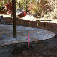
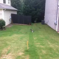
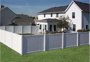
We locate original property corners using deed research and mathematical verification. Our flagged or staked boundaries guide fence installations and property improvements, preventing costly post-construction corrections with 100% accurate placement.
Questions
What services does Accurate Surveying and Planning provide?
We specialize in boundary dispute resolution, FEMA flood map updates, elevation certifications, site planning for permits, and property corner relocation services.
Why do I need a professional land survey?
Georgia's complex property laws require registered surveyors to establish legal boundaries, prevent encroachments, and ensure compliance with development regulations.
How quickly can you complete a survey?
Most boundary surveys are completed within 48 hours, with flood insurance documentation typically processed within 24 hours of request.
Do you serve commercial clients?
Yes, we provide surveying services for developers, municipalities, and government agencies across Georgia and North Carolina.
How do you handle flood insurance requirements?
We prepare FEMA-compliant elevation certificates and electronic map amendments to help property owners challenge flood zone designations.