Business Details
50+ Years
experience
Expert Surveying and Mapping Services in the Southeast U.S.
Founded in 1972, Southeastern Surveying (SSMC) is the largest surveying and mapping company in Florida, serving the Southeastern United States. As a 100% employee-owned firm, we combine decades of institutional knowledge with state-of-the-art technology to deliver customized, innovative solutions. Our expertise spans land surveying, subsurface utility engineering (SUE), geographic information systems (GIS), remote sensing/LiDAR, and hydrographic surveys. With over 50 years of operational history, we maintain a leadership position in responsiveness, service quality, and technological advancement. Our team of licensed professionals utilizes advanced tools like terrestrial LiDAR, GPS systems, and UAVs to ensure precision across all projects.We serve diverse sectors including transportation, utilities, and government agencies, with a focus on safety, efficiency, and client satisfaction. Our ESOP structure since 2017 has driven record growth while fostering a culture of ownership and accountability. We specialize in full-service project management, from initial data collection to final deliverables in compatible formats. Our commitment to ASCE standards and industry certifications ensures reliable, high-quality outcomes. With offices across Florida and the Southeast, we provide rapid response times and localized expertise to meet regional needs.
Services
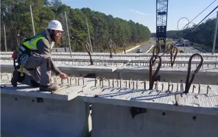
Land Surveying
Subsurface Utility Engineering
Geographic Information Systems
Remote Sensing/LiDAR
Hydrographic Surveys
Construction Support
GIS Mapping
Utility Location
Topographic Surveys
Boundary Surveys
Details
- Year established: 1972
Highlights and features
- We have over 50 years of experience in surveying and geospatial solutions.
- Our 100% employee-owned structure ensures accountability and quality.
- We utilize state-of-the-art LiDAR, GPS, and UAV technology.
- We maintain ASCE 38-02 compliance for subsurface utility engineering.
- Our team includes licensed professionals with regional expertise.
What people say
Very professional
Completed ahead of schedule
Trustworthy professionals
Exceeded expectations
Tireless diligence
Services
Land Surveying
Our land surveying services include boundary, topographic, and construction layout surveys using GPS and robotic total stations. We support residential, commercial, and infrastructure projects with precise measurements. Our licensed surveyors ensure compliance with state and federal regulations while delivering data in compatible digital formats.
Subsurface Utility Engineering
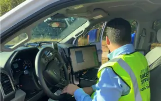
We locate and map underground utilities using ground-penetrating radar and vacuum excavation. Our ASCE 38-02 compliant services prevent damage during construction. We provide quality level A-D data collection and integrate findings with GIS systems for client accessibility.
Geographic Information Systems
Our GIS division creates spatial databases and mapping solutions for asset management and infrastructure planning. We convert data into actionable insights using ESRI software. Services include zoning analysis, condition assessments, and mobile imaging for transportation networks.
Remote Sensing/LiDAR
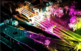
We conduct aerial and terrestrial LiDAR scans to generate high-resolution 3D models for design and analysis. Our TopoDOT software processes point clouds into deliverables like Revit models. Applications include corridor mapping and volumetric calculations for construction projects.
Hydrographic Surveys
We map underwater terrain using sonar and GPS for coastal engineering and dredging projects. Our surveys support nautical charting and environmental assessments. Data is processed into bathymetric maps and integrated with shoreline information for comprehensive analysis.
People
Thomas K. Mead
President | Principal in Charge
With 37+ years of experience, Thomas oversees project coordination and surveying operations. He specializes in boundary surveys, hydrographic mapping, and GPS services while leading SSMC's strategic direction.
Brian R. Garvey
GIS Vice President
Brian leads GIS database design and development with 38 years of expertise. He manages GPS asset inventories and specializes in data conversion and aerial mapping solutions for infrastructure projects.
Darryll E. DeMarsh
Utility Vice President
Darryll has 27 years of SUE experience, directing utility conflict verification and relocation projects. He ensures compliance with quality level standards and manages data integration with CAD systems.
Rebecca Gardiner-Bess
General Counsel
Rebecca provides legal oversight and strategic planning guidance. She manages administrative operations and serves on SSMC's board of directors to support company growth and governance.
William Rowe
Survey Construction Director
With 38 years in surveying, Bill specializes in CAD management and quality control. He coordinates staff to meet project database requirements and ensures accurate deliverables for government contracts.
Questions
What services does Southeastern Surveying & Mapping offer?
We provide land surveying, subsurface utility engineering, GIS mapping, LiDAR scanning, and hydrographic surveys using advanced technology for infrastructure projects.
Which areas do you serve?
We operate throughout Florida and the Southeastern U.S., including Alabama, Georgia, Louisiana, and North Carolina.
Are your surveyors licensed and certified?
Yes, our team includes licensed professionals with certifications in surveying, GIS, and subsurface utility engineering standards.
How does your employee-owned structure benefit clients?
Our ESOP model fosters accountability, innovation, and long-term commitment to client satisfaction and project quality.
What technologies do you use?
We utilize LiDAR, GPS systems, UAVs, ground-penetrating radar, and advanced software like ESRI ArcGIS and AutoCAD Civil 3D.
Can you handle large-scale infrastructure projects?
Yes, our experience with FDOT and utility companies demonstrates our capability to manage complex, large-scale projects efficiently.