Business Details
46 Years
experience
Professional Land Surveying & Civil Engineering Services in Red Wing, MN
Founded in 1980, Johnson & Scofield has built a reputation for delivering precise land surveying and comprehensive civil engineering solutions across Minnesota and Wisconsin. Our team of licensed professionals combines decades of collective experience with a commitment to personalized service, ensuring every project receives meticulous attention regardless of scale. We specialize in boundary surveys, topographic mapping, flood elevation certifications, and infrastructure design, supporting clients from initial planning through construction.Our approach integrates technical expertise with local knowledge to address unique site challenges while adhering to regulatory standards. With offices in Red Wing, Hastings, Wabasha, and Winona, we maintain a community-focused ethos while serving diverse industries requiring accurate spatial data and engineering excellence. Our history of successful projects demonstrates our ability to translate complex technical requirements into practical, cost-effective outcomes that meet client objectives.

Services
Boundary Surveys
Topographic Mapping
Flood Elevation Certificates
Subdivision Platting
Construction Staking
As-Built Surveys
Road Design
Sewer System Planning
Details
- Year established: 1980
Highlights and features
- We have over 40 years of combined experience in land surveying and civil engineering.
- Our team includes licensed professionals with expertise in boundary determination and flood zone analysis.
- We maintain four local offices to better serve Minnesota and Wisconsin communities.
- We provide detailed documentation meeting ALTA/ACSM and FEMA requirements.
- Our staff works directly with clients to develop cost-effective site-specific solutions.
Services
Boundary Surveys
Our boundary surveys establish precise property lines using historical records and field measurements. We place permanent monuments and create certified documentation for legal purposes. This service helps resolve disputes, support property transactions, and prevent encroachment issues.
Topographic Mapping
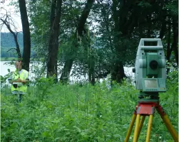
We create detailed topographic maps showing elevation changes and physical features. These surveys guide infrastructure planning, drainage solutions, and site development projects. Our data collection includes natural and man-made features for comprehensive analysis.
Flood Elevation Certificates
Our flood elevation surveys determine base flood elevations for FEMA compliance. We prepare documentation to challenge flood zone designations or establish accurate insurance requirements. This service helps property owners reduce unnecessary flood insurance costs.
Subdivision Platting
We handle both minor and major land subdivisions, preparing legal descriptions and required documentation. Our services include preliminary planning, topographic surveys, and final plat preparation for county approval and recording.
Construction Staking
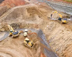
Our construction staking services provide precise reference points for infrastructure projects. We support road building, utility installation, and site grading with field verification throughout the construction process to ensure accurate implementation.
People
David A. Johnson
Co-Founder
Co-founder with extensive experience in land surveying, David Johnson leads technical operations while maintaining the company's commitment to precision and client service established since 1980.
Alan K. Scofield
Co-Founder
As co-founder, Alan Scofield focuses on engineering solutions and business development, leveraging decades of experience to expand service capabilities while maintaining technical excellence.
Questions
When do I need a land survey?
You need a land survey when purchasing property, building near property lines, applying for Torrens Title, or resolving boundary disputes.
What services do you offer for property development?
We provide subdivision platting, grading plans, utility staking, and hydraulic analysis for residential and commercial developments.
Do you handle flood zone determinations?
Yes, we conduct flood elevation surveys and prepare FEMA documentation to establish or challenge flood zone designations.
Are your surveyors licensed professionals?
All our surveying work is performed by licensed professionals meeting Minnesota and Wisconsin certification requirements.
Can you assist with construction project staking?
We provide precise construction staking for roads, utilities, and site improvements with regular field verification during projects.