Business Details
35 Years
experience
Trusted Land Surveying & Planning Services in Pennsylvania
Berks Surveying & Engineering, Inc. (BSE) has been delivering professional land planning and surveying services since 1991. Our team combines decades of experience with advanced technology to serve residential, commercial, agricultural, and industrial clients across Pennsylvania. We specialize in boundary surveys, subdivision planning, FEMA elevation certificates, and stormwater management, ensuring compliance with municipal regulations. Our reputation for precision and reliability has made us a preferred partner for homeowners, developers, and municipalities. With offices in Fleetwood, PA, we provide tailored solutions for projects ranging from small property surveys to large-scale land developments.Our licensed professionals, including certified surveyors and engineers, oversee every project to guarantee accuracy and adherence to industry standards. Clients appreciate our transparent communication, competitive pricing, and commitment to navigating complex zoning and permitting processes efficiently. Our extensive portfolio includes over 2,500 completed projects, reflecting our dedication to client satisfaction and technical excellence.
Services
Land Surveying
Subdivision Planning
FEMA Elevation Certificates
Stormwater Management
Boundary Surveys
Zoning Consultation
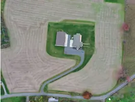
Drone Mapping
Septic Design
Erosion Control
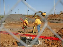
Construction Stakeout
Details
- Year established: 1991
Highlights and features
- We offer 33+ years of experience in Pennsylvania land surveying and zoning.
- Our team uses advanced GPS and drone technology for accurate results.
- We provide transparent pricing with free estimates for all projects.
- Our licensed professionals navigate complex municipal permitting processes efficiently.
- Clients praise our timely delivery and exceptional customer service.
What people say
Timely delivery
Professional staff
Transparent pricing
Municipal expertise
Accurate surveys
Services
Land Surveying
We conduct boundary, topographic, and ALTA surveys using GPS and robotic instruments. Our services ensure accurate property delineation for construction, fencing, or legal purposes. Clients receive detailed maps and documentation compliant with Pennsylvania regulations.
Subdivision Planning
Our team designs residential and commercial subdivisions, including annexation processes and municipal approvals. We handle zoning compliance, infrastructure planning, and environmental impact assessments to streamline project execution.
Stormwater Management
We create NPDES-compliant stormwater and erosion control plans for projects over one acre. Our solutions mitigate environmental impact while meeting county and municipal requirements for construction sites.
FEMA Elevation Certificates
We provide FEMA-certified elevation surveys to determine flood risk zones. Our services include LOMA applications to reclassify properties outside high-risk areas, supported by precise elevation data.
Drone Mapping
Using drone technology, we capture high-resolution orthoimagery and 3D models for land assessments. This method reduces costs and improves accuracy for large-scale projects like agricultural planning and construction monitoring.
People
Robert D. Hain
President/Principal
Licensed PA Surveyor and Drone Pilot with 26+ years at BSE. Oversees daily operations and client projects, specializing in land development and stormwater planning. Became owner in 2024.
Bruce T. Rader
Founder
Established BSE in 1991 with 32+ years in engineering and surveying. Managed projects across five counties and served in U.S. Army Reserves. Retired as active principal in 2024.
Cindy A. Cunard-Hogan
Office Manager
18+ years at BSE handling HR, accounting, and project coordination. Background in communications design and local business management. Serves as PA Notary Public.
Amanda Marbarger
Estimates Manager
Agricultural planning specialist with generational farming experience. Manages nutrient management plans and client estimates for surveying and development projects.
Daniel A. Graybill Jr.
Project Manager
18-year BSE veteran handling land surveying and civil design. Specializes in subdivision projects, erosion control, and municipal permitting processes.
Questions
What services does Berks Surveying & Engineering offer?
We provide land surveying, subdivision planning, stormwater management, FEMA elevation certificates, drone mapping, and zoning consultation for residential, commercial, and agricultural clients.
How do I request a free estimate?
Contact us via phone at 610-944-8528 or complete our online form to discuss your project details and receive a no-obligation estimate.
Do you serve areas outside Berks County?
Yes, we serve the Greater Reading area, Allentown, and adjacent counties in Pennsylvania for land surveying and planning projects.
What payment methods are accepted?
We accept credit card payments through our secure portal, excluding American Express. Invoices can also be paid via traditional methods.
How long does a typical survey take?
Most boundary surveys are completed within 2-4 weeks, depending on weather and project complexity. Emergency services are not offered.
Are your professionals licensed in Pennsylvania?
Yes, our surveyors and engineers hold active PA licenses, including certifications for sewage enforcement and drone operations.