Business Details
42 Years
experience
Expert Land Surveying Services in Mt. Pleasant, IA
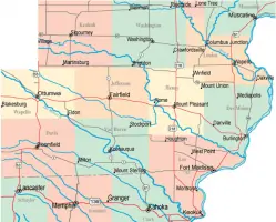
Since 1984, Lance Surveying Services has provided comprehensive land surveying solutions to clients across Southeast Iowa. Founded by John Lance after decades of industry experience, our father-son team combines generational expertise with modern methodologies to deliver precise and reliable results. We specialize in ALTA/NSPS surveys, elevation certificates, topographic mapping, and construction staking, supporting property line establishment, real estate splits, and multi-lot subdivisions.Our process begins with meticulous historical research to ensure regulatory compliance and boundary accuracy, working closely with local realtors, attorneys, and zoning authorities. With offices in Mt. Pleasant, we maintain a commitment to technical excellence, client collaboration, and adherence to evolving industry standards while serving both individual landowners and commercial developers.
Services
ALTA/NSPS Surveys
Elevation Certificates
Topographic Mapping
Construction Staking
Property Line Adjustments
Subdivision Plats
Retracement Surveys
Details
- Year established: 1984
Highlights and features
- We offer 40+ years of combined surveying experience in Iowa and Missouri.
- Our father-son team ensures personalized attention to every project.
- We collaborate with local realtors and attorneys for efficient real estate processes.
- We provide start-to-finish surveying for property lines and subdivisions.
- Our work adheres to strict regulatory standards for accuracy and compliance.
Services
ALTA/NSPS Surveys
Our ALTA/NSPS surveys meet national standards for commercial property transactions. We combine historical research with field measurements to identify boundaries, easements, and improvements. This service ensures title insurance readiness and compliance with lender requirements for real estate deals.
Subdivision Plats
We create subdivision plats for multi-lot developments requiring zoning compliance. Our process includes boundary determination, topographic mapping, and monument placement. We prepare legal descriptions and coordinate with local authorities for approval.
Construction Staking
Our construction staking ensures accurate project implementation. We translate design plans into physical markers for foundations, utilities, and infrastructure. This service maintains alignment with approved plats during development projects.
People
John H. Lance
Owner
With over 40 years of surveying experience, John founded the company in 1984 after obtaining Iowa licensure. He expanded expertise through Missouri licensing in 1998 and mentors the next generation while maintaining field involvement.
Rob Lance
IA PLS #21980
Licensed in 2010, Rob joined the firm in 2008 after gaining practical experience. He specializes in modern surveying technologies while upholding traditional boundary determination methods for accurate property assessments.
Ralyn Seberg
Office Manager
Ralyn coordinates administrative operations since joining in 2008. She manages client communications, project scheduling, and regulatory documentation to ensure smooth service delivery across Southeast Iowa.
Questions
What types of land surveys do you offer?
We provide ALTA/NSPS surveys, elevation certificates, topographic mapping, construction staking, property line adjustments, and subdivision plats for residential and commercial needs.
How are your surveying costs determined?
Most projects use a time-and-materials basis with competitive hourly rates. We provide estimates after initial research and offer bids for defined scopes.
Do you work outside Southeast Iowa?
While our primary service area is Southeast Iowa, we evaluate projects beyond this region based on complexity and resource availability.
What licenses do your surveyors hold?
John Lance holds Iowa and Missouri licenses. Rob Lance is licensed in Iowa (PLS #21980). Both maintain continuing education for regulatory compliance.
What happens during the survey research phase?
We examine historical records, legal descriptions, and prior surveys to establish boundary history. This critical step ensures accurate property line determinations and regulatory compliance.