Business Details
36 Years
experience
Professional Land Surveying Services in Ventura County
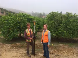
Founded in 1990, GP Salmen & Associates has provided cost-effective land surveying services in Ventura County for over 25 years. Our team, including founder Gary Salmen, LS, and his son Travis, specializes in boundary surveys, ALTA surveys, FEMA certifications, and topographic mapping. We excel at navigating local regulatory processes through our deep relationships with Ventura County agencies. Our approach prioritizes precisely identifying client needs and delivering comprehensive solutions efficiently.Many local real estate professionals, architects, and builders rely on our expertise for accurate, timely surveying services that meet all requirements the first time. With Gary's six-year journey to licensure and decades of experience, we uphold the highest standards of professionalism and technical excellence.
Services
Boundary Surveys
Topographic Surveys
ALTA Surveys
FEMA Certifications
Construction Staking
Parcel Maps
Easement Surveys
Height Surveys
Lot Line Adjustments
Development Surveys
Details
- Year established: 1990
Highlights and features
- 25+ years of local experience in Ventura County
- Proven expertise navigating local regulatory processes
- Hard commitments on project scope and timelines
- Family legacy of surveying excellence
- Direct communication with licensed land surveyors
Associations and certifications
- California Department of Consumer Affairs, Board for Professional Engineers, Land Surveyors, and Geologists
Services
Boundary Surveying
Boundary surveys precisely determine property lines to prevent encroachments and ensure proper land use. Our experienced team helps property owners planning fencing, construction, or remodeling projects meet local regulations. Using advanced technology and verified monuments, we provide legally defensible surveys that satisfy Ventura County requirements.
Topographic Surveys
Topographic surveys create detailed maps showing land elevations, natural features, and man-made structures. Our CAD-generated maps help architects and engineers plan developments with accurate drainage and clearance information. We deliver professional-grade topographic data fully integrated with boundary surveys when needed.
ALTA Surveys
ALTA/ACSM land title surveys meet lender and insurance requirements by identifying physical and title defects. We thoroughly examine encroachments, zoning compliance, and easement issues within five feet of property boundaries. Our ALTA surveys include detailed disclosures for commercial properties and residential developments.
FEMA Elevation Certificates
FEMA elevation certificates verify building elevations relative to flood plain designations. We help property owners qualify for LOMA adjustments and secure accurate flood insurance rates. Our certified surveys meet federal requirements for coastal zones, flood plains, and new developments.
Parcel Maps
Parcel maps legally divide larger properties into smaller parcels according to California Subdivision Map Act regulations. We manage both tentative and final map processes including agency coordination and recordation. Our subdivision surveys ensure compliance with local zoning and infrastructure requirements.
People
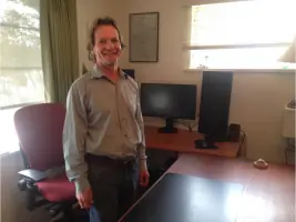
Gary Salmen
Founder & Licensed Surveyor
Licensed by California's BPELS in 1980 after six years of training, Gary established GP Salmen & Associates in 1990. He previously consulted for Ventura County's surveyor office and co-founded CLSA's review seminars. With expertise in regulatory compliance and boundary law, he ensures precision across all projects.
Questions
Why choose a local Ventura County surveyor?
Local surveyors understand regional regulations, terrain challenges, and monument control systems. This expertise ensures accurate surveys that meet county requirements while avoiding costly rework due to local-specific issues.
What causes survey cost variations?
Factors include parcel complexity, vegetation density, terrain steepness, and existing monument availability. Defective legal descriptions require additional research to establish valid points of beginning for accurate boundary determinations.
How do ALTA surveys differ from boundary surveys?
ALTA surveys meet specific lender requirements, combining boundary verification with easement checks and title defect assessments. They include detailed 5-foot boundary disclosures and compliance with uniform national standards.
What constitutes a legal monument?
Legal monuments include iron pipes, surveyor's marks on concrete, and permanent markers established by licensed professionals. Temporary stakes lack legal standing for permanent boundary definitions under California surveying law.
Why verify property lines before improvements?
Undocumented boundary estimates risk encroachments that could require expensive removal. Professional surveys ensure structures comply with setback requirements while protecting property owners' land rights through legally defensible documentation.
How do height surveys benefit hillside construction?
Height surveys confirm structures meet view protection and zoning height restrictions in sensitive hillside areas. Accurate measurements prevent costly modifications required to meet Ventura County's elevation limitations for new developments.