Business Details
11 Years
experience
Expert Land Surveying Services in Wallowa, Oregon
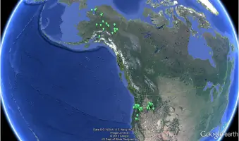
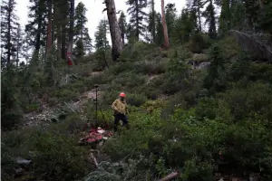
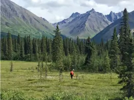
Welcome to Brockamp Land Surveying, a family-owned business rooted in tradition, expertise, and dedication. Established in 2015, we specialize in boundary resolution and large-scale survey projects, serving clients across the Pacific Northwest from Alaska to California. Our work in Wallowa Countyhome to North America's steepest canyonshowcases our ability to handle complex challenges in remote locations. Equipped with advanced tools like Leica GPS Receivers and Total Stations, we deliver precision-driven results that exceed expectations. Our team combines decades of field experience with a commitment to integrity, ensuring every project benefits from both technical expertise and ethical standards.Matt Brockamp, a licensed surveyor with extensive cadastral survey experience, leads our operations, supported by Austin Brockamp, whose early career and technical proficiency enhance our capabilities. We take pride in tackling intricate projects, from historical boundary reconstructions to modern construction surveys, while maintaining a client-focused approach. Our reputation for reliability and quality is built on completed projects in demanding terrains and testimonials from satisfied clients. Choosing Brockamp Land Surveying means partnering with professionals who bring precision, adaptability, and unwavering dedication to every assignment, regardless of scale or location.
Services
Boundary Surveys
Cadastral Surveys
FEMA Flood Mapping
Topographic Surveys
Boundary Line Agreements
Construction Surveying
Details
- Year established: 2015
Highlights and features
- We offer 25+ years of cadastral survey experience in remote Pacific Northwest terrains.
- Our family-owned business combines generational expertise with advanced surveying technology.
- We specialize in resolving historical boundary disputes dating back to 1881.
- Our team maintains 24/7 readiness for urgent survey project logistics.
- We guarantee accurate FEMA flood map resolutions and construction surveying.
What people say
Polite and kind
Thrive on challenges
Historical boundary experts
Exceed expectations
Client-focused approach
Services
Boundary Surveys
We conduct precise boundary surveys to resolve property line disputes and establish legal property limits. Our expertise extends to historical boundary reconstructions using century-old records, ensuring accurate determinations in challenging terrains. Clients benefit from our ability to integrate modern GPS technology with traditional surveying methods for comprehensive solutions.
Cadastral Surveys
Our cadastral surveys specialize in mapping property ownership and legal boundaries across the Pacific Northwest. With extensive experience in federal land systems, we provide authoritative documentation for title transfers and land development projects. This service ensures compliance with state and federal surveying standards while maintaining historical accuracy.
Topographic Surveys
We create detailed topographic maps for construction, environmental projects, and land development. Using advanced surveying equipment, we capture elevation data and natural features to support infrastructure planning. Clients rely on our precision in rugged landscapes where traditional surveying methods face limitations.
Construction Surveying
Our construction surveying ensures accurate layout for buildings, roads, and utilities. We provide stakeout services and as-built documentation to maintain project alignment with design specifications. Clients benefit from our ability to work in remote locations while maintaining tight tolerances required for modern infrastructure projects.
FEMA Flood Mapping
We deliver FEMA-compliant flood elevation certificates and map revisions for property owners and insurers. Our team specializes in resolving flood map discrepancies using field data collection and GIS analysis. This service helps clients reduce insurance costs and meet regulatory requirements for development in flood-prone areas.
People
Matt Brockamp
Owner/Manager
Licensed surveyor with 25+ years of experience in cadastral surveys across six western states. Developed award-winning survey techniques while leading remote projects since 2015. Holds registrations in California and Oregon.
Austin Brockamp
Survey Party Chief
Experienced surveyor trained since age 12, specializing in corner search and monumentation. Completed Alaska survey projects before joining Brockamp full-time. Proficient in all survey equipment and field logistics.
Questions
What areas does Brockamp Land Surveying service?
We operate throughout the Pacific Northwest, including Oregon, Washington, Idaho, California, and Alaska, handling projects in remote and challenging terrains.
How experienced is your team with historical surveys?
We specialize in resolving century-old boundary disputes using original 1881 survey records, with expertise in reconstructing historical land divisions across multiple states.
What equipment do you use for remote projects?
Our equipment includes Leica GPS Receivers, Total Stations, survey trucks, and off-road vehicles to access remote locations inaccessible by conventional means.
Can you handle both small and large projects?
Yes, we accommodate projects of all sizes from single lot surveys to multi-state infrastructure projects, scaling resources to meet each client's specific needs.
How do you ensure accuracy in rugged terrain?
Our team combines traditional field techniques with modern technology, employing specialized equipment and software to maintain precision in extreme geographic conditions.
Do you provide emergency survey services?
While not 24/7, we maintain rapid mobilization capabilities for urgent survey needs, prioritizing time-sensitive projects requiring immediate action.