
Business Details
20 Years
experience
Expert Engineering Solutions in Washington State
Contour Engineering has been a trusted leader in land development services since 2006, delivering tailored solutions for civil engineering, land surveying, and planning projects across Washington state. Our team of licensed engineers, surveyors, and planners combines technical expertise with a client-focused approach to transform visions into reality. With 15+ years of experience executing complex developmentsfrom 270-acre subdivisions to biodiesel plant evaluationswe prioritize accessibility, timely communication, and deep local government relationships.Our recent integration of FAA-certified drone technology enhances precision and efficiency for modern engineering challenges. Clients consistently recognize our honesty, industry connections, and ability to align with project timelines while maintaining the highest standards of professionalism.
Services
Civil Engineering
Land Surveying
Laser Scanning
Aerial Mapping
Land Planning
Drone Services
Details
- Year established: 2006
Highlights and features
- 15+ years executing complex land development projects
- FAA-certified drone pilots for survey-grade data collection
- Direct access to engineers, surveyors, and leadership
- Proven track record with local government approvals
- Honest, collaborative approach to project execution
Associations and certifications
- FAA 14 CFR Part 107
What people say
Exceptional customer service
Professional and seamless experience
Strong reputation with local governments
Outstanding experience
Honest and genuine approach
Services
Civil Engineering
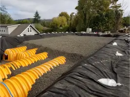
Our civil engineering team specializes in site development, utility systems, and roadway design for residential, commercial, and industrial projects. We manage permitting processes and regulatory compliance while optimizing land use efficiency. Clients benefit from our technical precision and deep understanding of Washington state's municipal requirements.
Land Surveying
We provide topographic surveys, boundary determinations, and construction staking using advanced GPS and robotic equipment. Our surveyors ensure accurate spatial data for development planning and legal documentation. Clients rely on our meticulous fieldwork and rapid turnaround times for critical project phases.
Drone Services
Our FAA-certified drone operations capture high-resolution aerial imagery and LiDAR data for site analysis and progress monitoring. The Matrice M-300 RTK drone enables efficient mapping of large areas with survey-grade accuracy. This technology reduces field time while enhancing data comprehensiveness for engineering decisions.
Land Planning
We create master plans balancing client objectives with environmental constraints and zoning regulations. Our planners coordinate with local jurisdictions to streamline approvals for subdivisions, mixed-use developments, and infrastructure projects. Clients value our ability to translate complex requirements into actionable, profitable solutions.
Laser Scanning
Terrestrial laser scanning captures detailed as-built conditions for existing structures and terrain. We convert point cloud data into precise digital models for renovation projects and construction verification. This technology minimizes field revisits while improving design accuracy for complex sites.
People
Mark Mauren
Representative
As Ueland Tree Farm's contact, Mark has collaborated with Contour Engineering on major land development projects since 2006, including large-acreage subdivisions and utility infrastructure design.
Nick Tosti
Developer
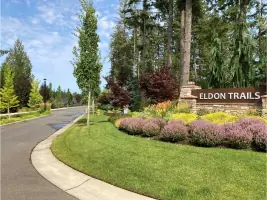
Nick leads master plan development for Cordillera Group and selected Contour Engineering for their civil engineering expertise in executing complex community build-outs across Washington state.
Questions
What engineering services do you specialize in?
We focus on civil engineering, land surveying, land planning, and drone-assisted mapping for residential, commercial, and industrial developments across Washington state.
How does your drone technology benefit projects?
Our FAA-certified drone operations capture survey-grade aerial data 40% faster than traditional methods, improving site analysis accuracy while reducing field costs.
Do you handle municipal permitting processes?
Yes, our team manages regulatory submissions and coordinates with local jurisdictions to streamline approvals for subdivisions and infrastructure projects.
What project sizes do you typically handle?
We execute developments ranging from 5-acre parcels to 270+ acre master plans, with experience in roads, utilities, quarries, and environmental assessments.
How do you ensure project timelines are met?
Our integrated engineering-surveying-planning workflow and direct client communication channels maintain schedule adherence across all project phases.