
Business Details
31 Years
experience
Expert Land Surveying Services in California
GUIDA has been a leader in professional land surveying since 1995, combining traditional methodologies with cutting-edge technologies to deliver accurate and reliable work products. Our team of licensed surveyors and technicians specializes in municipal and private projects across California, serving clients with personalized attention and technical excellence. Certified as both a Small Business Enterprise (SBE) and Women Owned Business Enterprise (WBE), we maintain strong family values while investing in the latest equipment and training to ensure project success.With offices strategically located from the Bay Area to San Diego, our firm consistently exceeds client expectations through innovative solutions and a commitment to quality. Guided by over 25 years of industry experience, we prioritize accuracy, timeliness, and client satisfaction in every surveying project we undertake.

Services
Land Surveys
Design Surveys
LiDAR Services
Right of Way Engineering
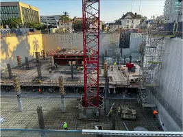
Construction Surveys
UAV Services
GIS Solutions
Geodetic Control
Utility Surveys
Construction Monitoring
Details
- Year established: 1995
Highlights and features
- We offer 30 years of specialized experience in California land surveying.
- Our firm pioneered UAV technology adoption for surveying in Southern California.
- We maintain 100% compliance with California's Subdivision Map Act and Business Professions Code.
- Our team includes licensed surveyors with expertise in utility detection using GPR and LiDAR.
- We operate from 6 strategic offices across California for rapid project response.
Associations and certifications
- Department of General Services (SBE)
- California Public Utilities Commission (WBE)
What people say
Top notch survey company
Exemplary customer service
Paperwork spot on
Great partner
Always there when needed
Services
Land Surveys
GUIDA's foundational service includes boundary surveys and cadastral mapping that comply with California's strictest legal standards. Our licensed surveyors use precise instruments and title research to establish property lines and resolve encroachment issues for residential, commercial, and municipal clients. With three decades of localized experience, we deliver accurate mapping that forms the basis for all subsequent development projects.
LiDAR Services
Our LiDAR technology captures detailed 3D point clouds for as-built documentation and construction monitoring. This non-invasive method generates precise digital elevation models that support infrastructure maintenance planning and complex engineering designs. The technology significantly reduces field time while maintaining sub-centimeter accuracy for critical transportation and utility projects.
Construction Surveys
GUIDA's construction surveyors provide layout staking, as-built verification, and monitoring services that align with project specifications. We use GPS/GNSS systems and robotic total stations to ensure dimensional accuracy during grading, utilities installation, and structure placement. Our services help prevent costly rework while maintaining compliance with Caltrans and local jurisdiction requirements.
Utility Surveys
We employ ground penetrating radar and electromagnetic detection to create comprehensive utility maps for project planning. Our surveys identify both metallic and non-metallic underground infrastructure, reducing excavation risks and compliance issues. Clients receive detailed as-built records that meet ASCE 38-02 standards for subsurface utility engineering.
UAV Services
Our FAA-certified drone operators conduct aerial surveys that produce georeferenced orthophotography and topographic models. UAV technology enables rapid data collection for large sites while maintaining survey-grade accuracy. This service supports right-of-way analysis, construction progress monitoring, and volumetric calculations for mining and earthwork projects across California.
People
Ralph W. Guida IV
CEO/President
Second-generation surveyor who founded GUIDA in 1995. He has developed the firm into a multi-office operation while maintaining strict technical standards and family values. His leadership focuses on industry innovation and professional development.
Meagan A. Guida
CFO
Strategic financial leader with 20+ years in A&E industry. She has driven GUIDA's geographic expansion and staff development since joining in 2000. Her growth strategies transformed the firm into a statewide service provider while maintaining quality controls.
Bernie McInally
Principal
Licensed surveyor with extensive experience in strategic growth initiatives. He focuses on expanding GUIDA's market presence while ensuring adherence to technical standards across all service lines.
Lisa Spivak
Principal
Operations executive responsible for maintaining GUIDA's quality assurance programs. With her oversight, the firm maintains compliance with state regulations and professional surveying standards.
Adrian Trespando
Principal
25-year veteran surveyor who leads Northern California operations. His technical expertise in complex land development projects has earned multiple industry recognitions and client trust.
Questions
What land surveying services does GUIDA offer?
GUIDA provides boundary surveys, construction staking, topographic mapping, right-of-way engineering, geodetic control, utility detection, and UAV-based aerial surveys.
Which industries does GUIDA primarily serve?
We primarily support transportation infrastructure, municipal development, utility companies, and private landowners across California.
Is GUIDA certified as a minority-owned business?
We are certified as a Women Owned Business Enterprise (WBE) by the California Public Utilities Commission.
How does GUIDA ensure survey accuracy?
Our licensed professionals use Trimble GNSS receivers, RTN networks, and multi-frequency LiDAR systems to maintain sub-centimeter precision in all deliverables.
Where does GUIDA operate within California?
We maintain offices from the Bay Area through Los Angeles to San Diego, allowing statewide coverage for all surveying projects.
What technology does GUIDA use?
Our equipment includes UAV drones, terrestrial LiDAR scanners, GPS/GNSS networks, and ground penetrating radar for subsurface utility mapping.