Business Details
17 Years
experience
Expert Land Surveying Services in Auburn, AL
We are a professional engineering and land surveying firm dedicated to serving the Auburn, Opelika, Lee County, and surrounding areas of Alabama. Established in 2009 as USA Surveying & Engineering, LLC, our company builds upon over three decades of combined experience from our founder, J. Keith Maxwell, who has operated in the industry since 1989. Our expertise spans ALTA title surveys, boundary surveying, drone LiDAR mapping, flood elevation certificates, and topographic surveys, supported by cutting-edge technology and a commitment to ethical practices.As a Service-Disabled Veteran Owned Small Business (SDVOSB), we prioritize timely project completion, client satisfaction, and adherence to the highest professional standards. Our teams deep local knowledge and technical proficiency ensure accurate, reliable solutions tailored to each clients unique needs, whether for residential, commercial, or governmental projects.

Services
ALTA Title Survey
Boundary Surveying
Drone LiDAR Mapping
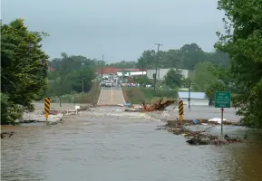
Flood Elevation Certificate
Topographic Survey
Land Development
Expert Witness Services
Storm Drainage Design
Sanitary Sewer Design
Water Systems Design
Details
- Year established: 2009
Highlights and features
- We offer over 30 years of combined experience in land surveying and civil engineering.
- Our team utilizes cutting-edge technology like drone LiDAR mapping for precision and efficiency.
- We provide expert witness services for legal disputes involving land boundaries and septic systems.
- Our firm is a certified Service-Disabled Veteran Owned Small Business (SDVOSB).
- We deliver comprehensive solutions, from flood elevation certificates to topographic surveys.
Associations and certifications
- Small Business Administration (SBA)
- Department of Veterans Affairs (VA)
- Alabama Society of Professional Land Surveyors (ASPLS)
What people say
True professional
Keen business skills
Highly recommend
Manage huge projects
Awesome attention to detail
Services
ALTA Title Survey
ALTA Title Surveys provide precise boundary documentation for commercial properties, adhering to national standards. These surveys identify easements, encroachments, and improvements, ensuring compliance with lender and title insurance requirements. Our team uses advanced equipment and thorough deed research to deliver accurate, legally defensible results.
Boundary Surveying
Boundary surveys establish property lines, detect encroachments, and resolve disputes. Our process includes deed analysis, field monumentation, and detailed mapping to clarify ownership. This service ensures compliance with Alabama surveying standards and supports real estate transactions or development projects.
Drone LiDAR Mapping
Drone LiDAR mapping captures high-resolution topographic data for land development and infrastructure projects. This technology enables cost-effective, large-scale surveys with millimeter-level accuracy. Applications include 3D modeling, floodplain analysis, and construction planning across Alabamas diverse terrain.
Flood Elevation Certificate
Flood Elevation Certificates determine a propertys flood risk and insurance requirements. Our surveys measure base flood elevations and finished floor levels to support FEMA compliance. This service helps clients secure accurate insurance rates and navigate floodplain management regulations.
Topographic Survey
Topographic surveys map natural and man-made features, including elevation contours and utility lines. These surveys support engineering design, site planning, and environmental assessments. We use conventional and aerial methods to balance precision with project efficiency.
People
J. Keith Maxwell
Principal/Manager
J. Keith Maxwell is a licensed Professional Engineer and Land Surveyor in Alabama with over 30 years of experience. He holds a B.C.E. and M.C.E. from Auburn University and is a Certified Floodplain Manager. Keith has served as an adjunct instructor at Auburn University and leads USA Surveying & Engineering, specializing in civil engineering and land surveying solutions.
Questions
What is an ALTA Title Survey, and why do I need one?
An ALTA Title Survey follows national standards to map property boundaries, easements, and improvements for commercial transactions. Lenders and title insurers require it to mitigate legal risks.
How much does a boundary survey cost in Alabama?
Costs range from $1,500 to $5,000, depending on parcel size, terrain, and deed complexity. We provide estimates after reviewing your property’s specific requirements.
Can drone LiDAR mapping reduce surveying costs?
Yes, drone technology accelerates data collection for large areas, reducing labor expenses while maintaining high accuracy for topographic and infrastructure projects.
What is a Flood Elevation Certificate used for?
This certificate determines flood insurance rates by measuring a building’s elevation relative to FEMA’s base flood level, ensuring compliance with floodplain regulations.
Do you offer expert witness services for land disputes?
Yes, we provide expert testimony and survey-based evidence for legal cases involving boundary conflicts, septic systems, and construction practices.
What areas do you serve?
We primarily serve Auburn, Opelika, Lee County, and surrounding Alabama regions, including Tuskegee, Elmore, Tallapoosa, and Coosa Counties.