Business Details
50+ Years
experience
Your Trusted Partner for Professional Land Surveying Solutions
Since 1971, Krisch Land Surveying has been a trusted provider of professional land surveying services in Illinois. Our family-owned business operates from Plainfield and Downers Grove, delivering high-quality surveying, consulting, and mapping solutions to private and public sector clients. Equipped with state-of-the-art robotic total stations, GPS technology, and advanced CAD software, we ensure accuracy, timeliness, and cost-effectiveness in every project.Our team of qualified survey and CAD technicians handles projects of all sizes, supported by memberships in prestigious organizations like the Illinois Professional Land Surveyors Association and the National Society of Professional Surveyors. With decades of experience and a commitment to technological innovation, we maintain a reputation for excellence in land surveying.
Services
ALTA/NSPS Surveys
Boundary Surveys
Topographic Surveys
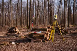
Construction Staking
Commercial Surveys
As-Built Surveys
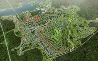
Mapping Services
Elevation Certificates
Details
- Year established: 1971
Highlights and features
- Family-owned expertise since 1971 with deep local knowledge
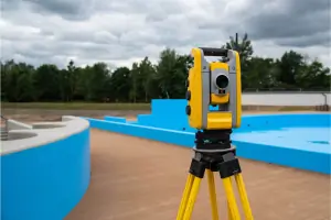
- Equipped with state-of-the-art robotic total stations and GPS equipment
- Provides free online estimates with 24-hour response
- Staffed by qualified and experienced survey and CAD technicians
- Handles projects of all sizes with precision and efficiency
Services
ALTA/NSPS Surveys
Our ALTA/NSPS surveys meet national standards for commercial property transactions. We deliver precise boundary determinations, easement identifications, and title insurance requirements. Clients receive detailed reports that satisfy lenders and title companies for risk mitigation.
Boundary Surveys
We establish accurate property boundaries using historical records and modern GPS technology. Our surveys resolve disputes, support land development, and ensure regulatory compliance. Clients receive certified documentation for legal and construction purposes.
Topographic Surveys
Our topographic surveys capture natural and man-made features with high-precision equipment. Data supports site planning, engineering design, and environmental assessments. Deliverables include contour maps and digital elevation models for construction projects.
Construction Staking
We provide precise staking for building foundations, utilities, and infrastructure. Our team uses robotic total stations to translate design plans into physical markers. Contractors receive accurate grade checks and alignment verification throughout projects.
Elevation Certificates
We prepare FEMA-compliant elevation certificates for flood insurance requirements. Our surveys document building elevations relative to flood zones. Clients receive official forms with precise measurements to determine risk and insurance costs.
Questions
What areas do you serve?
We provide land surveying services throughout Illinois, with primary offices in Plainfield and Downers Grove.
What survey types do you specialize in?
Our specialties include ALTA/NSPS land title surveys, boundary determinations, topographic mapping, construction staking, and elevation certificates.
How quickly can you provide estimates?
We offer free online estimates with guaranteed 24-hour response times for all project inquiries.
What technology do you use?
We utilize robotic total stations, GPS equipment, and advanced CAD software for field data collection and mapping deliverables.
Are your surveyors licensed?
Yes, our team includes Professional Land Surveyors (PLS) licensed in Illinois with decades of combined experience.