
Business Details
19 Years
experience
Professional Land Surveying & Design Services in Asheville, NC
Since 2007, Cole Surveying & Design has been a trusted provider of professional land surveying and design services in Asheville and throughout Western North Carolina. Originally established as Wes Cole Land Surveying, our firm expanded its offerings in 2019 to include landscape architecture, historic preservation, and regulatory compliance assistance while maintaining our commitment to precision and quality. Our team combines decades of experience with cutting-edge technology, including aerial drone surveying and ALTA survey expertise, to deliver accurate, reliable results for clients across diverse industries. Founder J. Wes Cole, a licensed Professional Land Surveyor in three states, personally oversees projects to ensure adherence to the highest standards. Our Director of Landscape Architecture, Hillary Cole, brings specialized knowledge in historic preservation and sustainable design.We serve clients from project inception through completion, offering comprehensive support tailored to each project's unique requirements. Our licenses in North Carolina, South Carolina, and Tennessee enable regional service capabilities, while our investment in UAV technology enhances data collection efficiency. Client testimonials consistently highlight our attention to detail, technical proficiency, and dedication to client satisfaction. We maintain active certifications in floodplain surveying and construction documentation, reinforcing our technical expertise. Our mission remains focused on delivering surveying services that combine traditional craftsmanship with modern innovation, ensuring our clients receive solutions that stand the test of time.
Services
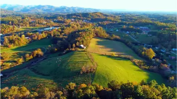
Aerial/UAV Drone
Land Planning & Visioning
Landscape Architecture
Surveying & Mapping
Historic Preservation
Details
- Year established: 2007
Highlights and features
- Licensed surveyors in North Carolina, South Carolina, and Tennessee
- Specialized ALTA survey expertise since 2007
- Licensed landscape architects with historic preservation credentials
- Certified floodplain surveyors and construction documentation technicians
- Investment in UAV drone technology for enhanced accuracy
What people say
Outstanding job
No detail overlooked
Highly recommend
Accurate surveying
Reliable service
Services
Aerial/UAV Drone
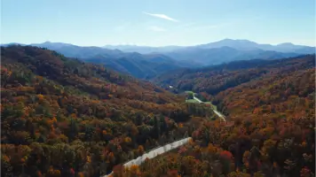
Our UAV drone technology enables high-precision aerial mapping and topographic surveys. This service provides cost-effective, rapid data collection for construction sites, land development, and environmental monitoring. Licensed operators ensure compliance with FAA regulations and deliver accurate geospatial data for project planning.
Land Planning & Visioning
We create comprehensive land use plans integrating survey data with development goals. Our visioning services help clients optimize property usage while meeting regulatory requirements. This includes zoning analysis, site feasibility studies, and master planning for residential and commercial developments.
Landscape Architecture
Our licensed landscape architects design functional outdoor spaces preserving historical context. Services include site design, planting plans, and sustainable stormwater management. We specialize in integrating modern needs with historic preservation requirements for municipal and private clients.
Surveying & Mapping
We provide boundary, topographic, and construction surveys meeting state licensing standards. Our services include ALTA/ACSM surveys for commercial properties and floodplain mapping. Advanced equipment ensures precise measurements for legal documentation and development projects.
Historic Preservation
Our team documents historic structures and sites using modern survey techniques. We create preservation plans meeting National Park Service standards and assist with regulatory approvals. This includes architectural inventory surveys and restoration planning for protected properties.
People
J. Wes Cole
Founder/Director of Surveying
Licensed surveyor since 2007 with NC, TN, and SC credentials. Holds certification as NC Floodplain Surveyor #150. Specializes in ALTA surveys and UAV technology applications. Graduated from East Tennessee State University with surveying degree.
Hillary Cole
Director of Landscape Architecture
Registered Landscape Architect in NC and SC with historic preservation certification. Holds credentials as Certified Plant Professional and Construction Document Technician. Graduated from University of Colorado at Denver with master's in Landscape Architecture.
Questions
What surveying services do you offer?
We provide boundary surveys, ALTA/ACSM surveys, topographic mapping, construction staking, and UAV drone surveys. Our services meet legal and engineering standards for residential, commercial, and government projects.
Are you licensed in multiple states?
Yes, our surveyors hold active licenses in North Carolina, South Carolina, and Tennessee. This allows us to serve clients across the Southeastern United States with consistent quality standards.
How does drone surveying benefit projects?
UAV technology enables faster data collection with minimal site disturbance. It provides high-resolution aerial mapping and 3D modeling, reducing field time and improving accuracy for large or complex sites.
Do you handle historic preservation projects?
Yes, our team includes certified historic preservation specialists. We document existing conditions, create preservation plans, and ensure compliance with local, state, and federal historic regulations.
What construction surveying services are available?
We offer layout staking, elevation control, and as-built documentation. Our services ensure proper grading, utilities placement, and structural alignment according to approved plans and specifications.