
Business Details
10 Years
experience
Professional Land Surveyors in Missoula, MT
Garland Land Surveying is a certified small business specializing in cadastral land surveying services across Montana, Idaho, and Colorado. Founded in 2016 by Jeremy Garland, our team combines over 15 years of industry experience with a passion for precision and client-focused solutions. We prioritize timely service delivery, utilizing advanced technology to meet the unique needs of government agencies and private sector clients. Our expertise includes boundary surveys, ALTA/NSPS surveys, FEMA floodplain assessments, and topographic mapping. With a proven track record in government contracts, including work with the U.S.Forest Service, we deliver accurate, cost-efficient results for projects of all scales. Our commitment to transparency and technical excellence ensures clients receive actionable data tailored to their specific requirements. By maintaining small-company responsiveness, weve built lasting partnerships with architects, developers, and landowners who rely on our expertise. Every project undergoes rigorous quality control, adhering to Bureau of Land Management standards and regional specifications. This dedication to professionalism has established us as trusted partners in land surveying solutions.
Services
Ranch Surveys
Boundary Surveys
FEMA Surveys
Topographic Mapping
ALTA/NSPS Surveys
Cadastral Surveys
Floodplain Verifications
Boundary Disputes
Elevation Certificates
Government Surveys
Details
- Year established: 2016
Highlights and features
- Certified Small Business with 15+ years of combined surveying experience
- Specialize in cadastral surveys for government land management projects
- Utilize advanced technology for accurate boundary determinations
- Maintain 100% project completion rate since 2016
- Direct collaboration with U.S. Forest Service and local agencies
Services
ALTA/NSPS Surveys
ALTA/NSPS Surveys provide comprehensive boundary analysis for property transactions. These surveys identify easements, encroachments, and improvements to satisfy lender and title insurance requirements. Our team follows American Land Title Association standards to deliver precise documentation for commercial real estate transactions.
FEMA Floodplain Surveys
FEMA Floodplain Surveys determine property risk zones for insurance purposes. We produce elevation certificates and LOMA applications to challenge floodplain designations. Our surveys help clients reduce insurance costs through accurate floodplain verification and documentation.
Topographic Mapping
Topographic Mapping creates detailed terrain models for development projects. We document existing features to support construction planning and zoning compliance. These surveys serve as foundational data for engineering and architectural design across Montana and Idaho.
Cadastral Surveys
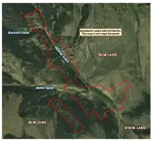
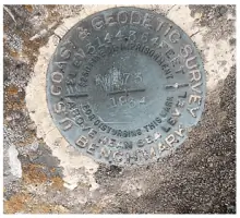
Cadastral Surveys establish legal property boundaries for government and private clients. Our team conducts retracement surveys of the Public Land Survey System to resolve disputes and manage federal land parcels. We follow BLM standards for monumentation and boundary documentation.
Boundary Dispute Resolution
Boundary Dispute Resolution services help property owners clarify contested land lines. We perform historical research and field verification to produce legally defensible boundary determinations. Our surveys support legal proceedings and neighborly resolutions for encroachment issues.
People
Jeremy Garland
Founder
Jeremy Garland founded Garland Land Surveying in 2016 after 15 years in the surveying profession. He specializes in cadastral surveys and government contracts, leading projects across Western Montana and Northern Idaho. His team utilizes modern technology to deliver precise boundary solutions for public and private clients.
Questions
What areas do you serve?
We provide land surveying services throughout Montana, Idaho, and Colorado with primary operations based in Missoula, Montana.
What survey types do you specialize in?
Our specialties include cadastral surveys, ALTA/NSPS surveys, FEMA floodplain assessments, topographic mapping, and boundary dispute resolution for government and private clients.
How quickly can you complete a survey?
Project timelines vary by scope, but our small-company responsiveness ensures prompt scheduling and efficient completion of cadastral and boundary surveys.
Do you handle government contracts?
Yes, we hold a Prime Cadastral Surveying IDIQ contract with the U.S. Forest Service and have completed multiple federal boundary surveys since 2017.
What technology do you use?
Our team employs the latest land surveying equipment and office software to ensure precise measurements and accurate digital mapping for all project types.