Business Details
8 Years
experience
Professional Drone Services in Sherman, TX
Brads Drones TX, LLC was founded in 2018 by Brad Bigham, a full-time police officer with the Sherman Police Department. Our team specializes in aerial photography, videography, mapping, and construction site documentation using advanced drone technology. With FAA-certified pilots and over $5 million in liability insurance, we deliver precise data acquisition for industries requiring RTK/PPK mapping, LiDAR scanning, and high-resolution imaging. Our expertise includes navigating FAA airspace authorizations and implementing LAANC systems for restricted operations. We maintain strict compliance with aviation regulations while providing tailored solutions for commercial clients across Texas.Our equipment inventory includes WISPR Systems, DJI, and Autel platforms with specialized payloads for photogrammetry and topographic mapping. We prioritize client satisfaction through transparent communication, customized pricing, and guaranteed service delivery. Our insurance coverage and technical proficiency ensure reliable operations for both simple and complex projects. We collaborate with surveyors and engineers while maintaining clear professional boundaries regarding data interpretation. Our commitment to quality is demonstrated through hundreds of documented flight hours and successful project completions since establishment.
Services
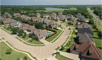
Aerial Photography
Drone Mapping
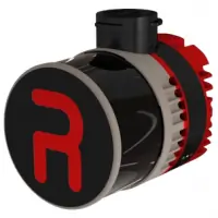
LiDAR Scanning
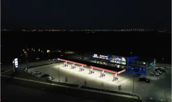
Construction Documentation
Drone Training
Details
- Year established: 2018
Highlights and features
- FAA-certified pilots with hundreds of commercial flight hours
- $5 million liability insurance for complete project protection
- Expertise in FAA airspace authorization and LAANC implementation
- Customized pricing for specialized drone mapping requirements
- Guaranteed client satisfaction through transparent operations
What people say
Exceptional quality
Professional service
Reliable operations
Expert knowledge
Timely delivery
Services
Aerial Photography
Our FAA-certified pilots capture high-resolution aerial photographs using advanced drone technology. This service provides precise visual documentation for real estate, construction, and industrial applications. Clients receive professional-grade imagery with accurate geospatial data.
Drone Mapping
We create detailed digital maps using RTK/PPK-enabled drones and specialized software. This service supports land surveying, construction monitoring, and environmental assessments. Clients receive accurate topographic data and 3D models for professional analysis.
LiDAR Scanning
Our LiDAR payloads generate precise point cloud data for terrain modeling and infrastructure analysis. This technology penetrates vegetation for accurate ground mapping. Clients receive detailed elevation models and volumetric measurements for engineering projects.
Construction Documentation
We document construction progress through regular aerial surveys and time-lapse imaging. This service tracks project timelines and verifies work completion. Clients receive organized data packages for stakeholder reporting and quality control.
Drone Training
Our FAA-certified instructors provide hands-on drone operation training. This includes airspace navigation, safety protocols, and data collection techniques. Clients gain practical skills for commercial drone applications and regulatory compliance.
People
Brad Bigham
Owner/Operator
Brad Bigham is a FAA-certified drone pilot with over 200 flight hours. He manages the Sherman Police Department's drone program and holds $5 million liability insurance. His expertise includes FAA airspace authorization and commercial drone operations.
Questions
What drone services do you offer?
We provide aerial photography, mapping, LiDAR scanning, construction documentation, and FAA-certified training using WISPR, DJI, and Autel platforms.
Are your pilots FAA-certified?
Yes, all our pilots hold FAA Part 107 certifications with hundreds of documented commercial flight hours.
Do you carry liability insurance?
We maintain a $5 million liability insurance policy for all commercial operations.
Can you operate in restricted airspace?
Our team has FAA LAANC authorization capabilities and successfully obtains airspace permissions for restricted areas.
What equipment do you use?
We operate WISPR SkyScout and Ranger Pro drones, DJI Matrice systems, RESEPI LiDAR payloads, and Sony mapping cameras.
Do you offer equipment financing?
Yes, we provide financing options for drone purchases and equipment packages.
Videos