Business Details
31 Years
experience
Environmental Consulting & Surveying Services Since 1995
Since 1995, Stephens Environmental Consulting has delivered comprehensive environmental, engineering, and surveying solutions to commercial, industrial, and governmental clients across Maryland, Delaware, and Pennsylvania. Our team combines over 80 years of collective expertise with cutting-edge technology, including drone-based mapping and GPS surveying, to address complex environmental challenges. We specialize in Phase I/II Environmental Site Assessments, wetland delineations, remediation projects, and land planning, supported by in-house GIS capabilities. Our proven track record includes managing Superfund and LUST site closures, earning approvals from major lending institutions and regulatory agencies.With a focus on innovation and environmental stewardship, we provide tailored solutions for brownfield revitalization, stormwater management, and coastal restoration. Our staff maintains strong relationships with regional regulators, ensuring efficient project permitting and compliance. Backed by decades of experience in hydrogeologic investigations and civil engineering design, we deliver cost-effective, value-driven results for clients ranging from private developers to state transportation agencies.
Services
Environmental Site Assessments
Wetland Delineations
Drone Surveying
GIS Mapping
Remediation Services
Hydrogeologic Investigations
Civil Engineering Design
GPS Surveying
Land Planning
Indoor Air Purification
Details
- Year established: 1995
Highlights and features
- We offer 30+ years of environmental consulting expertise
- Our team utilizes state-of-the-art drone and GPS technology
- Proven success in Superfund and LUST site closures
- Collective 80+ years of experience in hydrogeologic engineering
- Approved by major lending institutions and regulatory agencies
Services
Environmental Site Assessments
We conduct Phase I/II Environmental Site Assessments following ASTM standards. Our assessments identify contamination risks and regulatory compliance requirements for real estate transactions. Services include hazardous site evaluations, remedial investigations, and feasibility studies for commercial-industrial properties.
Drone-Based Mapping
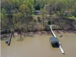
Our FAA-certified pilots provide drone-based 3D mapping and topographic modeling. Applications include construction monitoring, volume measurements, and natural resource restoration tracking. We deliver georeferenced orthomosaic imagery compatible with GIS software for comprehensive site analysis.
Wetland Delineations
We perform wetland identification and boundary mapping for regulatory compliance. Services include restoration planning, creation design, and permitting assistance. Our work supports environmental impact assessments and mitigation strategies for development projects.
Hydrogeologic Investigations
We analyze groundwater flow, contamination transport, and aquifer characteristics. Services include pump testing, water appropriation permitting, and stormwater management planning. Our models support remediation design and environmental impact assessments for industrial and municipal clients.
Civil Engineering Design
We provide site planning, drainage design, and shoreline stabilization solutions. Services include subdivision design, erosion control, and marina expansion projects. Our designs integrate regulatory requirements with practical construction considerations for sustainable land development.
People
Bill Stephens
President
Geologist with extensive Superfund and LUST site remediation experience. Led DNREC's first-fund site closures and managed complex environmental assessments across the Tri-State Area.
Questions
What environmental services does Stephens Environmental offer?
We provide Phase I/II ESAs, wetland delineations, remediation services, and Superfund/LUST site management. Our expertise includes regulatory compliance and environmental due diligence for real estate transactions.
Do you provide surveying services?
Yes, we offer conventional and GPS surveying, ALTA/NSPS land title surveys, and drone-based mapping. Our services support land development, construction monitoring, and natural resource management projects.
What geographic areas do you serve?
We primarily serve Maryland, Delaware, and Pennsylvania. Our staff maintains strong relationships with regional regulators and has extensive experience in the Delmarva Peninsula and Tri-State Area.
Can you handle complex remediation projects?
Yes, our team has decades of experience with hazardous waste sites, including remedial design, construction oversight, and regulatory closure processes for Superfund and state voluntary cleanup programs.
Do you offer drone-based services?
Yes, we provide FAA-compliant drone services for mapping, construction monitoring, and aerial photography. Our deliverables include 3D models, orthomosaic imagery, and GIS-compatible datasets for various applications.
Videos