Business Details
Professional Aerial Photography and Commercial Real Estate Services in Houston
Founded over 35 years ago, Positive Image has established itself as a premier provider of aerial photography and graphic design services for commercial real estate professionals, property owners, and public sector entities. Our team of certified pilots and photographers operates state-of-the-art aircraft and drones equipped with the latest imaging technology to deliver high-quality visual solutions. With a local service area spanning a 50-mile radius of Houston and the capability to support projects nationwide and internationally through our network of partners, we combine technical expertise with creative vision to meet client needs.Our extensive stock library, including historical aerial photographs dating back to the 1950s, offers immediate solutions for time-sensitive projects. As a founding member of the Professional Aerial Photographers Association International and holders of FAA-certified drone operations, we maintain rigorous standards of excellence while adapting to evolving industry demands. Our commitment to client collaboration ensures that every project aligns with specific marketing and documentation goals, from architectural photography to geospatial data visualization.
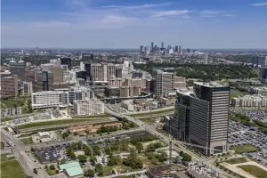
Services
Commercial Real Estate Photography
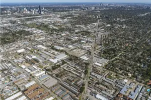
Custom Aerial Photography
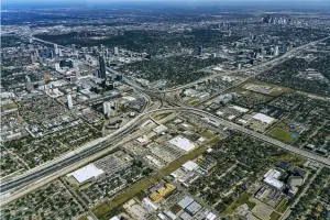
Stock Aerial Photography
Historical Aerial Photography
Computer Graphics
Highlights and features
- We offer 35+ years of specialized expertise in aerial photography and real estate imaging.
- Our team includes FAA-certified drone operators and in-house pilots for reliable service.
- We maintain one of Texas' most extensive stock aerial photography libraries dating to the 1950s.
- Our certified photographers use cutting-edge equipment for superior image quality.
- We provide global support through our network of professional aerial photographers.
Associations and certifications
- Professional Aerial Photographers Association International
- Federal Aviation Administration (FAA)
What people say
Excellent quality
Saved money
Essential to marketing
Perfect shot
Best-kept secret
Services
Commercial Real Estate Photography
Our commercial real estate photography combines technical precision with artistic composition to highlight property features. Using specialized lenses and lighting techniques, we create visually compelling images that enhance marketing materials. Services include interior/exterior shoots, post-processing enhancements, and digital asset management tailored to brokers' and developers' branding needs.
Custom Aerial Photography
We provide tailored aerial photography using FAA-certified drones and manned aircraft. Our team plans flights based on client objectives, considering optimal lighting, altitude, and weather conditions. This service delivers high-resolution images for site analysis, construction documentation, and marketing campaigns requiring unique perspectives.
Stock Aerial Photography
Our extensive stock library offers immediate access to thousands of aerial images of Houston and Texas regions. These pre-captured images, shot under ideal conditions, provide cost-effective solutions for time-sensitive projects. The collection includes urban development areas, transportation hubs, and commercial corridors with historical coverage dating to the 1950s.
Historical Aerial Photography
We maintain a unique archive of historical aerial photographs from the Harper Leiper collection, documenting Houston's development since the 1950s. These black-and-white images serve as valuable resources for urban planning, environmental studies, and corporate heritage projects, with research support for location-specific requests.
Computer Graphics
Our graphic design team creates marketing materials using GIS data and digital imaging software. Services include brochure design, custom maps, photo annotation, and print production. We offer full-service solutions from concept to final printing, incorporating aerial imagery and branding elements for real estate presentations and reports.
Questions
What geographic areas do you cover for aerial photography?
We cover Houston's 50-mile radius and Texas cities like Austin and San Antonio, with international support through our photographer network.
Can I accompany you on photography flights?
Our insurance policy prohibits passengers during photography flights for safety reasons.
How do you determine what to photograph during shoots?
We conduct pre-shoot interviews to understand client needs and develop customized shot lists based on project goals.
What are your image copyright policies?
We retain image ownership but grant original purchasers extensive usage rights for their projects.
How does weather affect aerial photography?
Weather significantly impacts quality; we prioritize safety and may use stock images if conditions prevent optimal shoots.
What differentiates drone and traditional aerial photography?
Drones capture low-level detail up to 400 feet, while manned aircraft provide broader perspectives for large-scale projects.