
Business Details
Commercial Photographer in Phoenix, AZ
Patti Reznik Photography has been delivering high-quality commercial photography services for over two decades. Specializing in aerial, architectural, construction progress, and real estate development photography, we serve clients across Arizona and the Southwest region. Our expertise extends to capturing properties from the air using helicopters and fixed-wing platforms, with GPS-enabled software integration for design teams. Certified by the City of Phoenix as a Small Business Enterprise and Disadvantaged Business Enterprise, we are a female-owned company committed to exceeding client expectations through meticulous attention to detail.Our services support construction documentation, legal matters, insurance needs, and marketing initiatives, with rush service available for time-sensitive projects. With galleries showcasing specialized work in transportation, energy, and golf course photography, we blend artistic vision with technical precision to deliver images suitable for boardrooms, websites, and annual reports.

Services
Aerial Photography
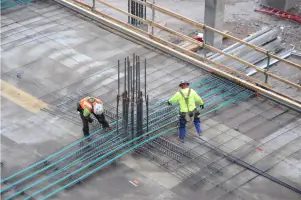
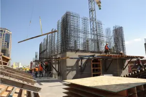
Construction Photography
Architecture Photography
Real Estate Photography
Transportation & Energy Photography
Highlights and features
- 20+ years of specialized commercial photography experience
- Expert aerial documentation using helicopters and fixed-wing platforms
- GPS-enabled software integration for design teams
- Female-owned certified Small Business Enterprise (SBE)
- Full-release copyright included with all photography services
Associations and certifications
- PAPA International
- City of Phoenix SBE
- City of Phoenix DBE
What people say
Top quality services
Prompt and on time
Incredible photos
Best quality expectations
Careful documentation
Services
Aerial Photography
Our aerial photography services capture comprehensive property views using helicopters and fixed-wing platforms. Ideal for construction documentation, real estate marketing, and infrastructure projects, this service provides GPS-integrated imagery for precise design coordination. We deliver high-resolution images that showcase development progress and property context.
Construction Photography
We document construction phases from site preparation to completion with consistent angles and altitudes. This service tracks project progress for stakeholder communication, marketing materials, and archival purposes. Monthly on-site photos ensure accurate visual records of development milestones across commercial and residential projects.
Architecture Photography
Our architecture photography highlights structural design through strategic lighting and composition. This service produces images suitable for marketing portfolios, annual reports, and digital platforms. We emphasize building features and spatial relationships to showcase architectural achievements effectively.
Real Estate Photography
We create compelling real estate visuals that emphasize property value and location context. This service includes access road documentation, landscape integration, and contextual elements for marketing materials. Our images help clients showcase developments to potential buyers and investors.
Transportation & Energy Photography
Specializing in roadway, light rail, and solar installation photography, this service documents large-scale infrastructure projects. We capture energy facilities and transportation networks at optimal times to highlight operational contexts. These images support government reporting, investor relations, and public information campaigns.
People
Patti Reznik
Owner & Lead Photographer
With over 20 years of experience, Patti Reznik combines artistic vision with technical expertise in aerial and commercial photography. Certified by PAPA International, she leads projects requiring precision documentation for construction, architecture, and infrastructure clients across the Southwest.
Questions
What commercial photography services do you offer?
We specialize in aerial, architectural, construction progress, real estate development, transportation, and energy photography using helicopters and fixed-wing platforms.
Which areas do you serve?
We serve Phoenix, Glendale, Peoria, Scottsdale, and all Arizona counties including Maricopa, Pima, and Coconino, plus Southwest regional clients.
How does aerial photography benefit construction projects?
Our aerial documentation tracks progress with consistent angles, creating visual timelines for stakeholders and marketing materials throughout development phases.
Do you provide copyright releases?
Yes, we include full-release copyright with all photography services for client marketing and archival use.
Is rush service available?
Yes, we offer expedited photography services for time-sensitive projects needing immediate documentation.
What experience do you have with infrastructure projects?
We've documented roadway construction, light rail systems, and commercial solar installations since 2003 using GPS-integrated imaging techniques.