
Business Details
33 Years
experience
Expert Land Surveying Services in Fort Wayne, IN
Sauer Land Surveying, Inc. has been delivering precise and reliable land surveying services since 1993. Founded by John C. Sauer and now co-owned by Wade Hacker and Joseph R. Herendeen, our team brings over 75 years of combined experience in residential and commercial surveying. We specialize in boundary surveys, ALTA/NSPS Land Title Surveys, topographical mapping, and erosion control design, utilizing cutting-edge GPS and robotic equipment to ensure accuracy. Our expertise in navigating municipal regulations and project timelines ensures efficient solutions for clients across Northeast Indiana. Committed to innovation, we continually invest in technology and staff training to exceed client expectations.With offices in Fort Wayne, we serve Allen County and surrounding areas, offering free estimates and personalized service to protect your property investment. Our team includes licensed professionals and engineers with decades of field experience, ensuring every project meets rigorous industry standards. We prioritize transparency, delivering detailed surveyor reports and visual documentation to clarify property lines and easements. From residential land divisions to complex commercial developments, our goal is to provide actionable data that safeguards your interests. This dedication to precision and client-focused service has established us as a trusted partner in land surveying solutions.
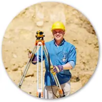


Services
Residential Surveys
Commercial Surveys
Boundary Surveys
Topographical Mapping
ALTA/NSPS Surveys
Erosion Control Design
Utility Planning
Engineering Services
Details
- Year established: 1993
Highlights and features
- We offer 30+ years of combined experience in residential and commercial surveying.
- Our team utilizes cutting-edge GPS and robotic equipment for maximum accuracy.
- We provide free estimates and detailed surveyor reports for all projects.
- Our staff includes licensed professionals with expertise in municipal regulations.
- We serve Northeast Indiana with localized knowledge of regional land requirements.
Services
Residential Surveys
Residential surveys establish property boundaries for real estate transactions or improvements. Our licensed surveyors use GPS technology to map corners, easements, and setbacks. Clients receive detailed drawings and reports to protect their investments during home purchases or construction projects.
Commercial Surveys
Commercial surveys support land development and construction projects. We provide staking, platting, and topographical mapping for developers and municipalities. Our team ensures compliance with zoning regulations while optimizing lot layouts and infrastructure planning for commercial properties.
Boundary Surveys
Boundary surveys determine legal property lines through document research and field measurements. We set physical stakes and create official records to resolve disputes or prepare for land divisions. This service includes comprehensive analysis of historical records and modern GPS verification.
Topographical Mapping
Topographical surveys document natural and man-made features of a property. We create elevation models and contour maps for construction planning or environmental assessments. Our digital mapping integrates with engineering software to support development projects.
ALTA/NSPS Surveys
ALTA/NSPS surveys meet national standards for commercial property transactions. These detailed surveys identify boundaries, improvements, and encumbrances for title insurance purposes. We coordinate with lenders and attorneys to ensure compliance with legal requirements for major real estate deals.
People
Wade Hacker
Co-Owner
Co-owner with 28+ years of field surveying experience. Graduated from ITT Technical College and specializes in grading, staking, and complex commercial/residential surveys using advanced GPS equipment.
Joseph R. Herendeen
Co-Owner
Co-owner and Professional Surveyor with expertise in subdivision design and municipal routing procedures. Apprentice of founder John Sauer, continuing legacy of creative plat layouts and regulatory compliance.
Holly A. Miller
Professional Engineer
Licensed Professional Engineer with specialized skills in engineering design and project implementation. Joined in 2025 to expand technical capabilities for complex surveying and development projects.
Questions
What types of surveys do you offer?
We provide residential boundary surveys, commercial development surveys, ALTA/NSPS title surveys, topographical mapping, and erosion control design services.
Why should I get a land survey?
A certified survey protects your investment by confirming property lines, identifying easements, and preventing disputes when buying property or planning improvements.
How long does a survey take?
Most residential surveys take 3-5 business days for proposal review. Field work duration varies based on property size and complexity.
Do you serve areas outside Fort Wayne?
We primarily serve Allen County and surrounding areas in Northeast Indiana with specialized knowledge of local regulations.
Can I get a free estimate?
Yes, we offer free cost and time frame proposals for all surveying projects through our online request form.
What technology do you use?
We utilize GPS systems, robotic total stations, and Carlson Survey software to ensure maximum accuracy and detailed visual documentation.